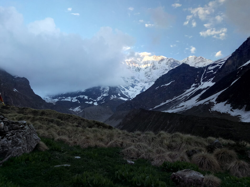
The Panpatia Glacier prevails at an exceptional elevation of 17,257 feet and connects two of India’s esteemed pilgrimage sites, Kedarnath and Badrinath. Shrouded in a halo of myths and legends, the Panpatia Col trek persuades you just how gorgeous and deadly nature can be. The most fascinating legend that masked the trek was that in early times priests and sages could make the journey from Badrinath to Kedarnath in just one day!
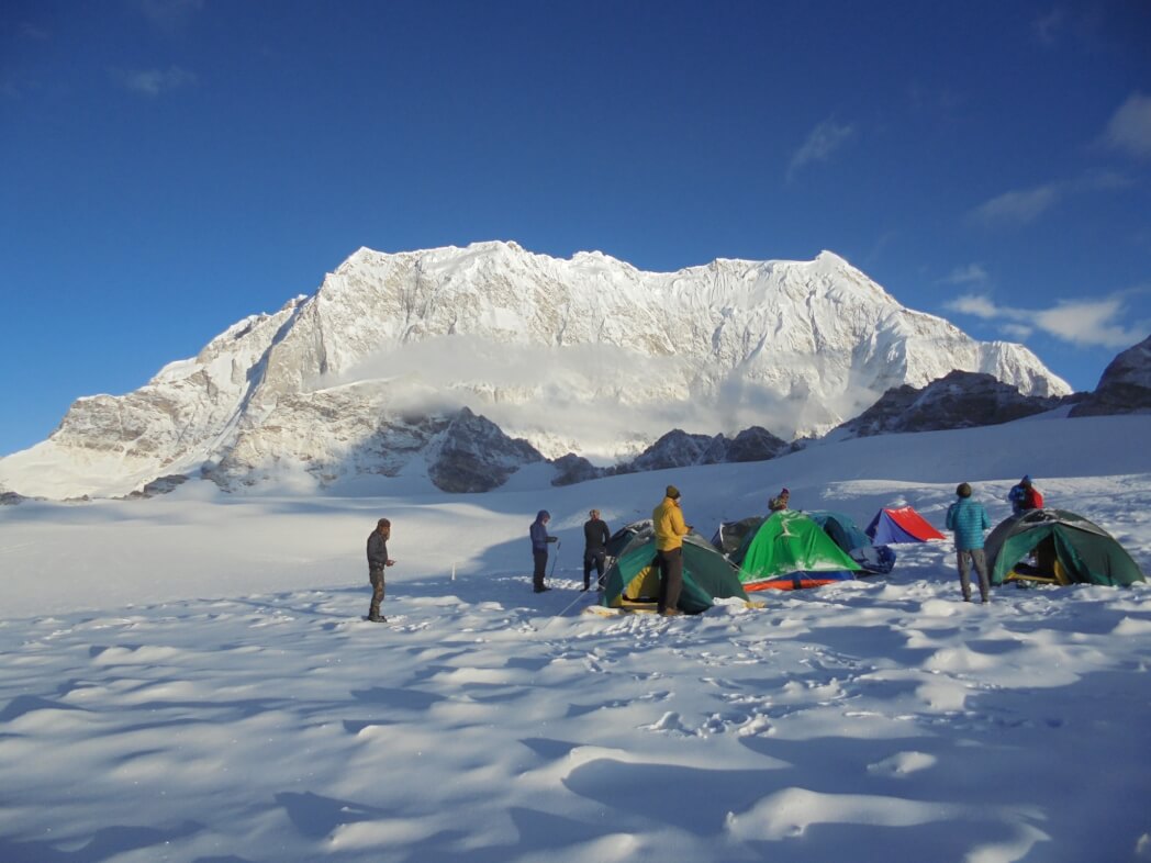
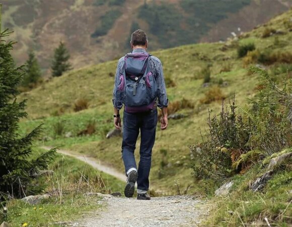
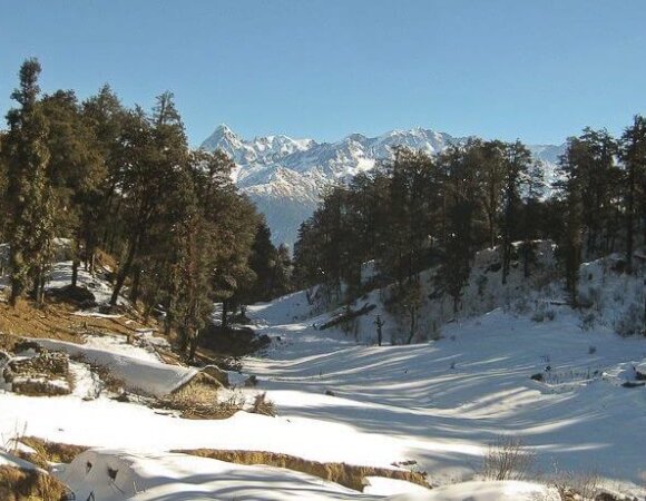
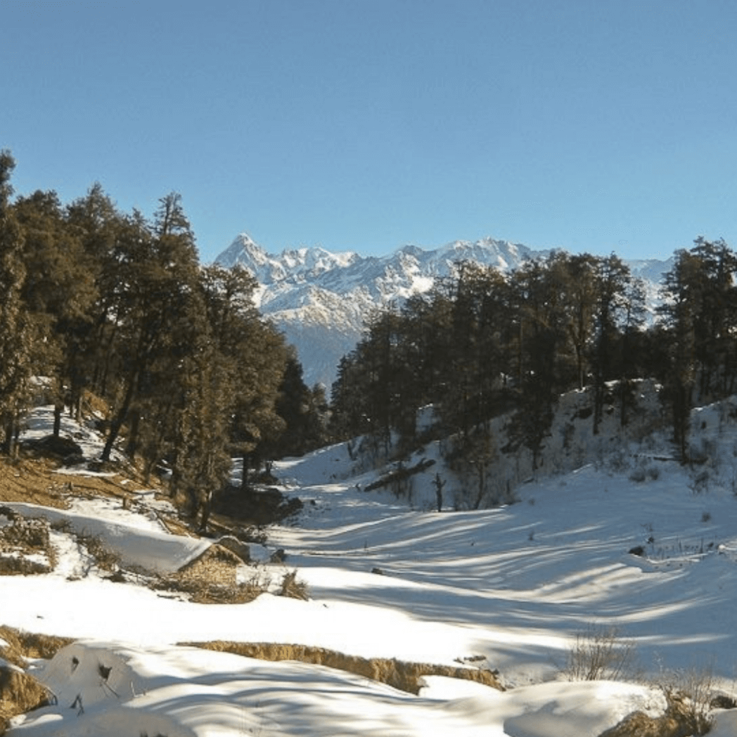
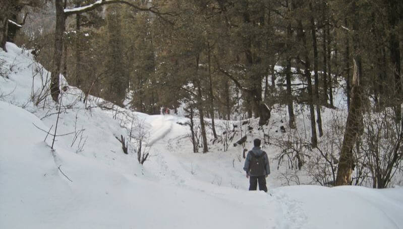
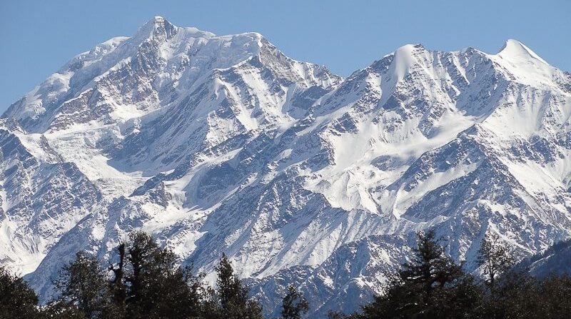
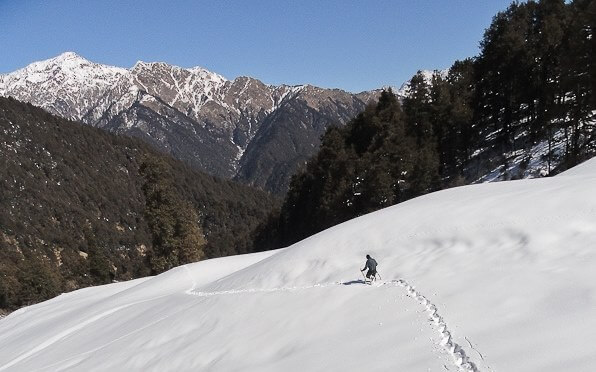
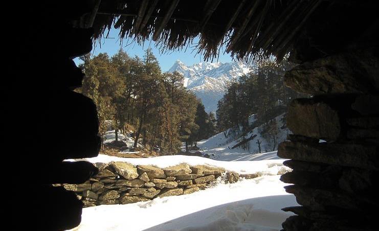
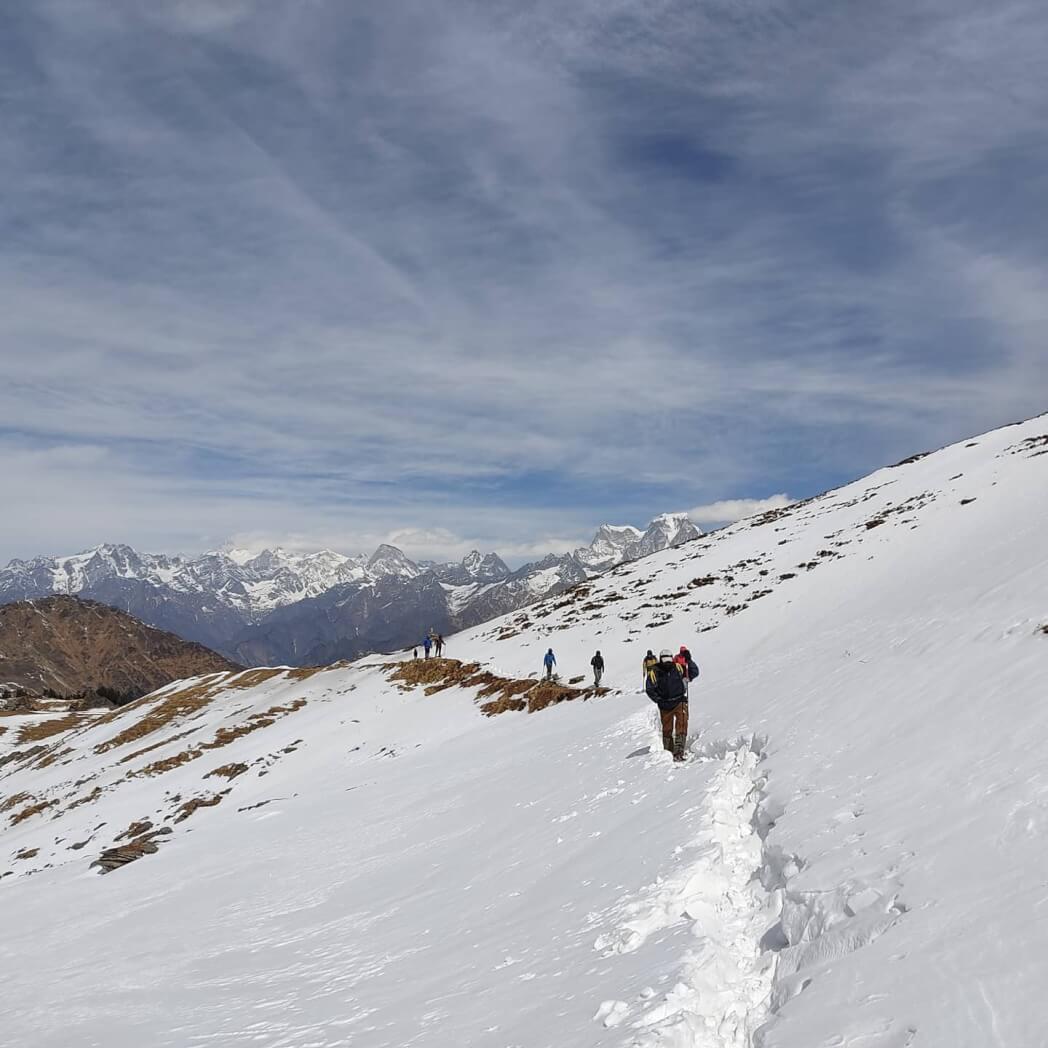
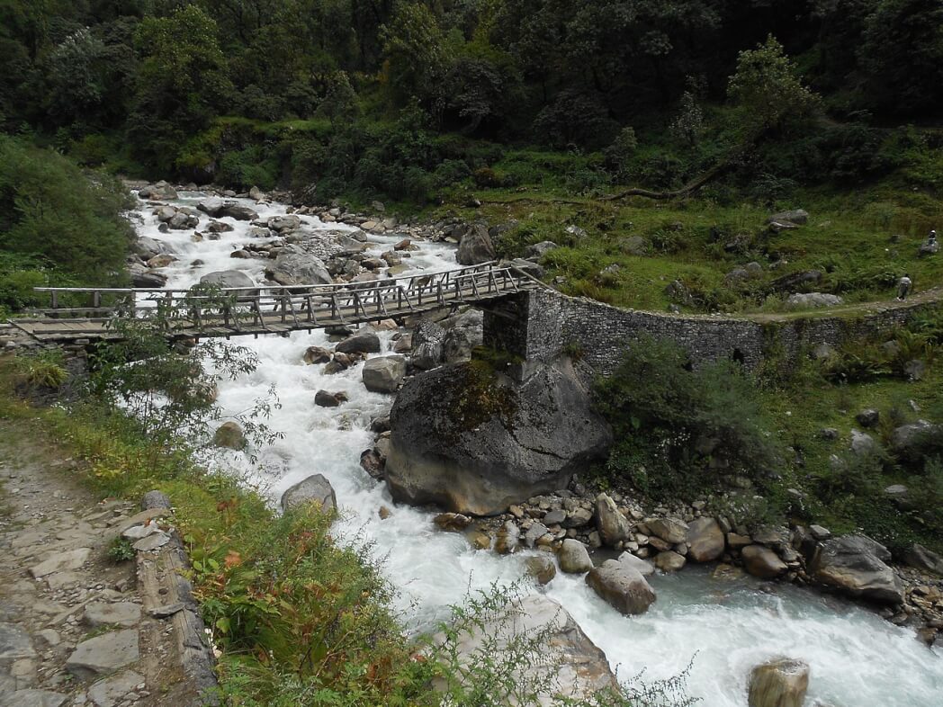
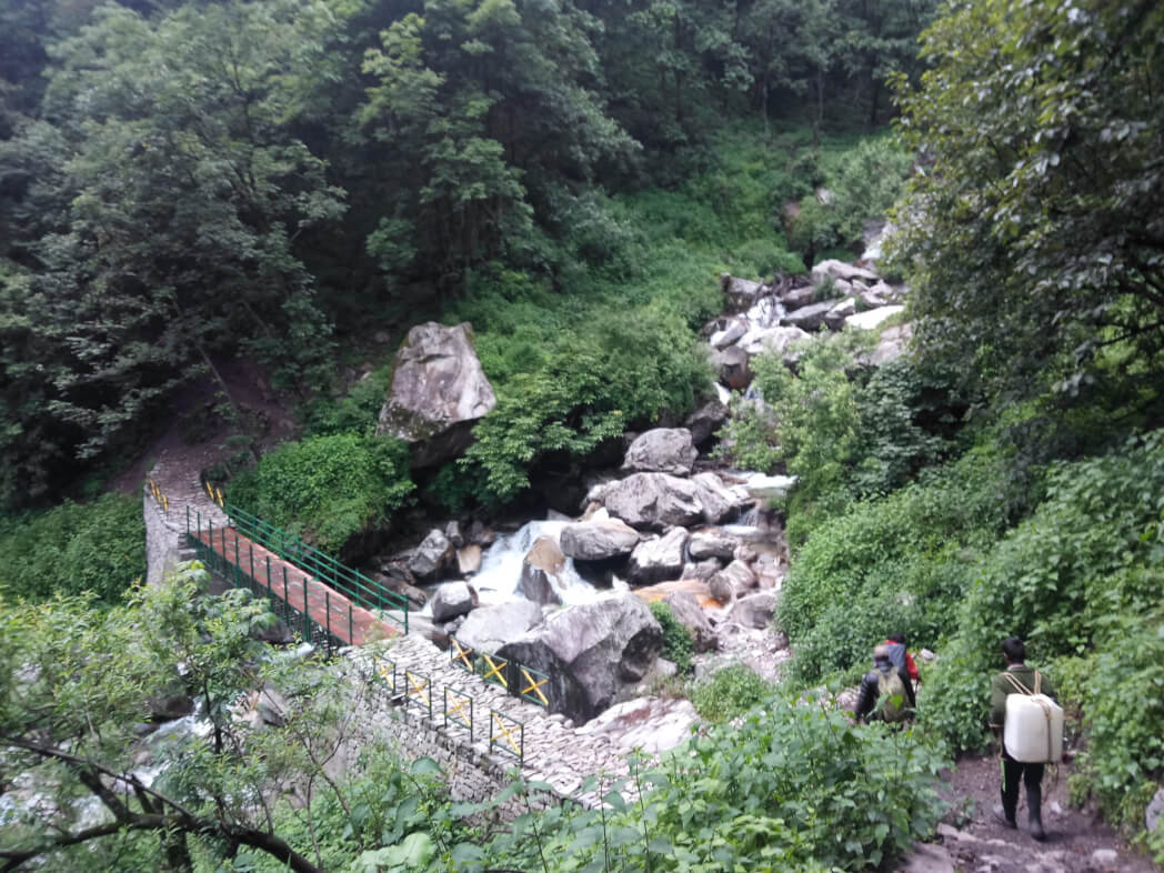
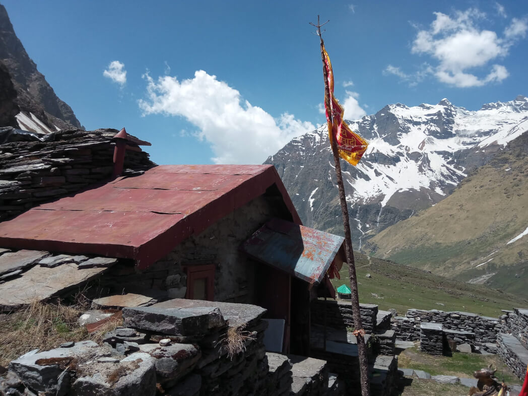
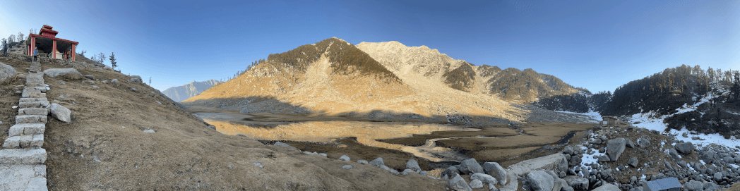
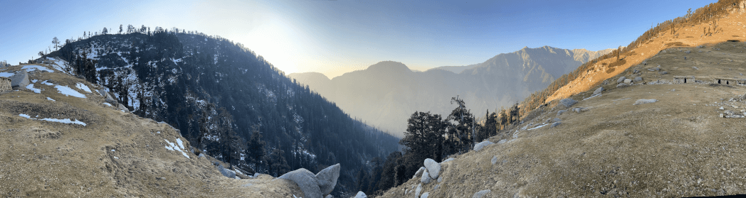
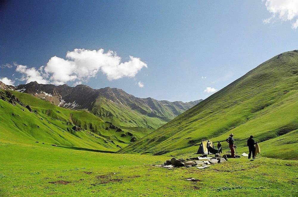
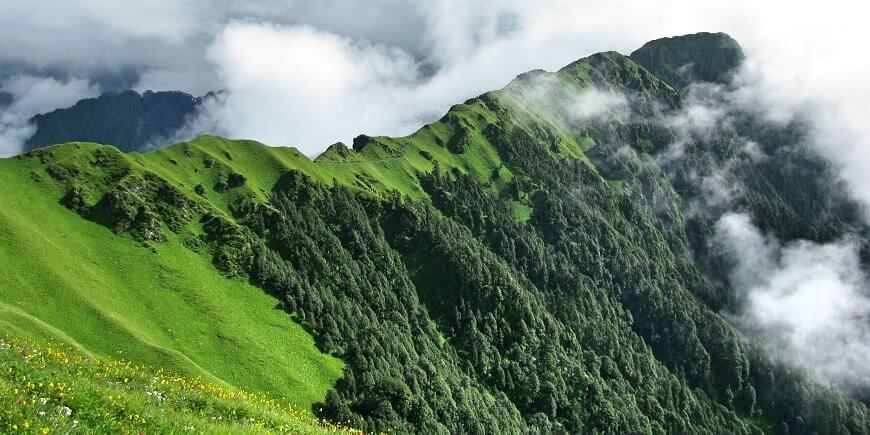
Being One of the most difficult treks in Uttarakhand, the Panpatia Col Trek tests your endurance and confidence. The Panpatia Glacier Hiking Trail begins from Badrinath and finally arrives at Nilkanth Khal. It is home to some of the most picturesque campgrounds and greens perched along the tranquil shores of glacial lakes. it spreads out a carpet of vivid floral varieties that captivates the senses. the view uncovers great Himalayan giants such as Nilkantha, Chaukhamba, Nanda Devi, Kunaling and Balakun. Admire the stunning view of the face of the current glacier and the Panpatia plateau.
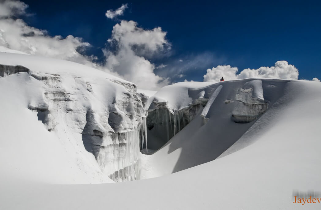
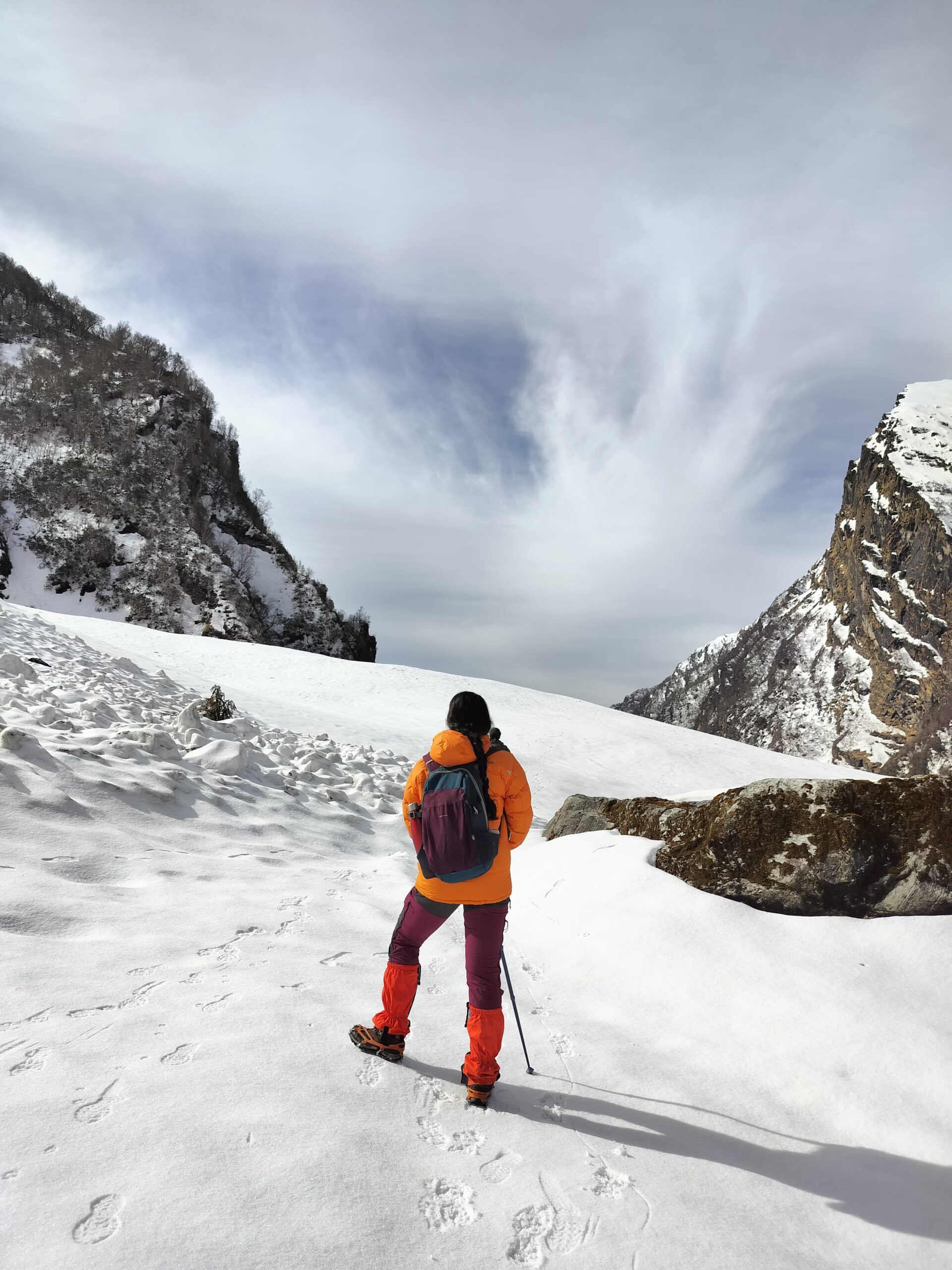
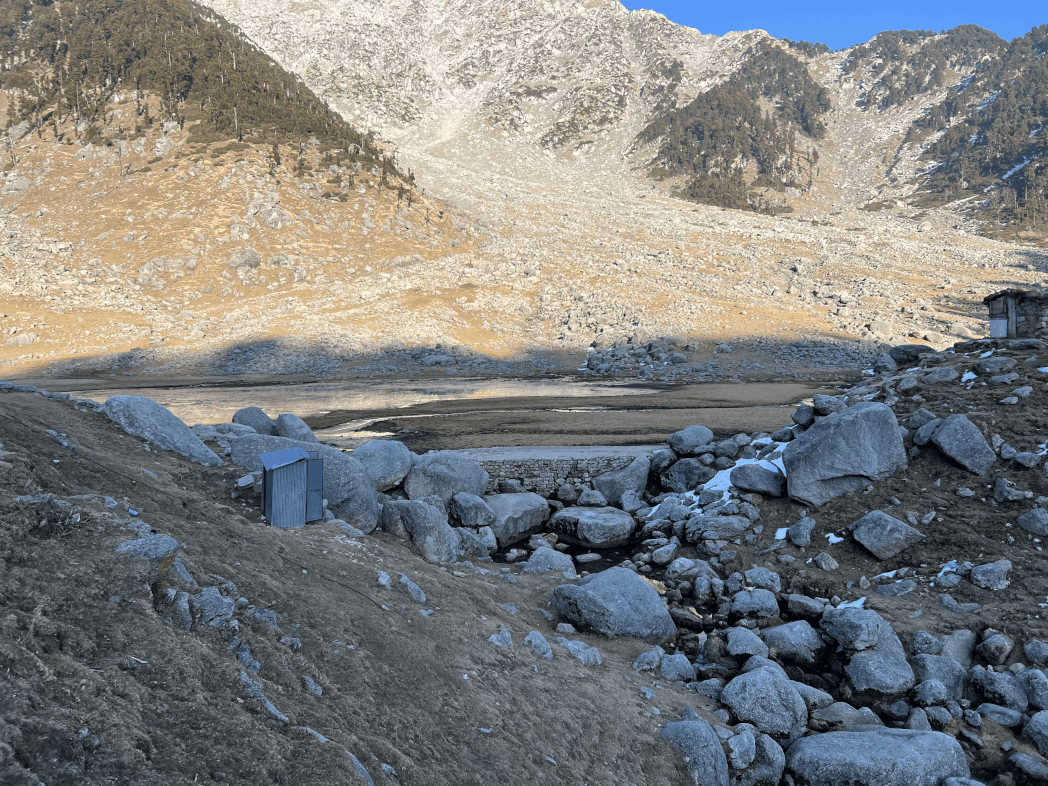
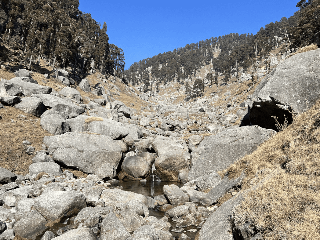
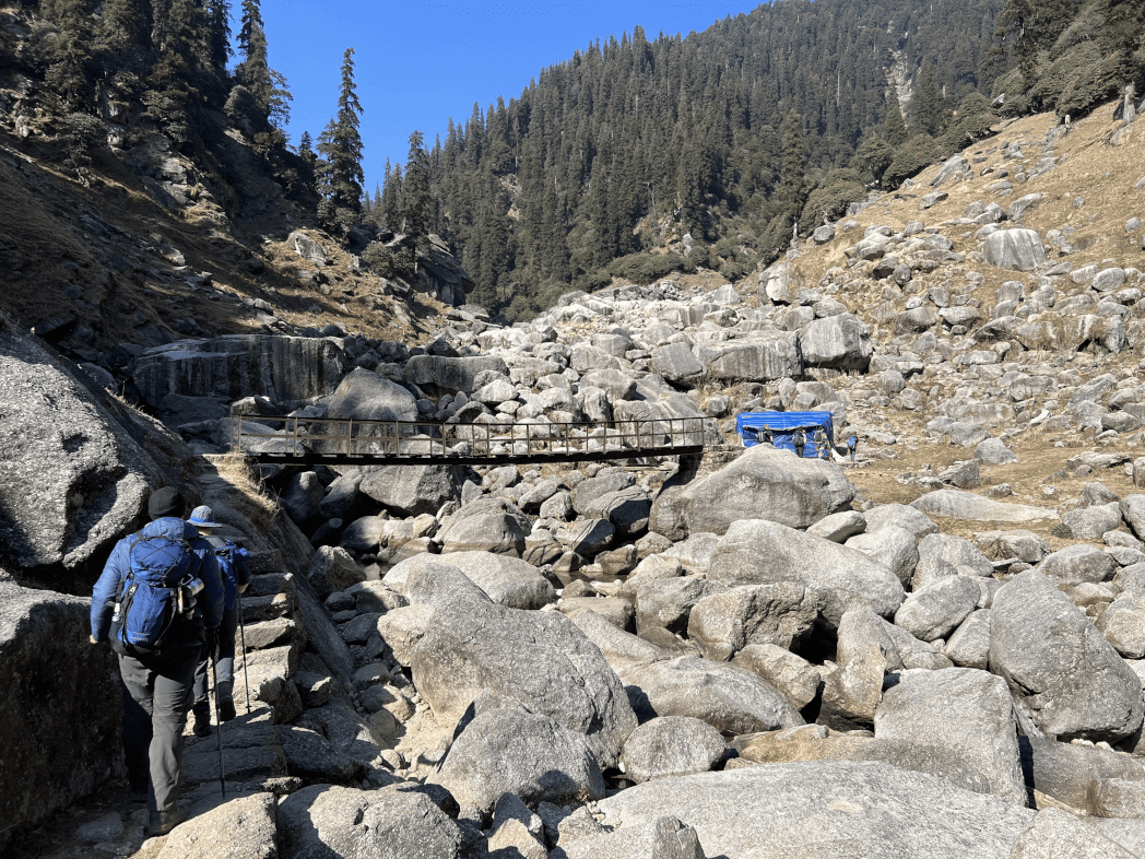
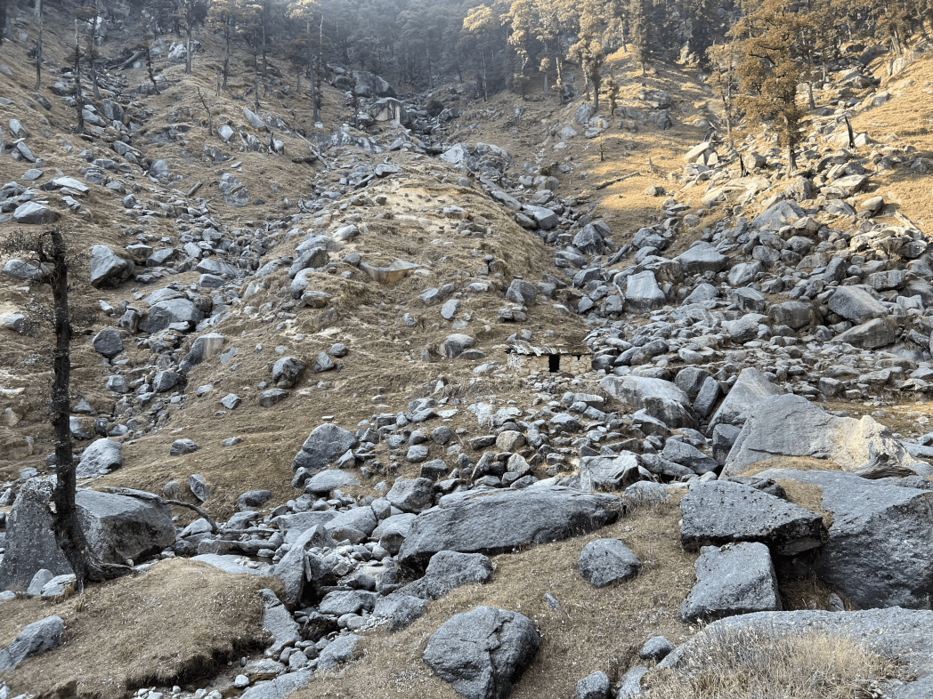
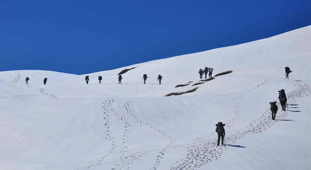
Although the trail is bumpy in some regions and loaded with unsecured rocks, crevices, and icefall, no other trek can compare to the elegance and scenic glimpses of its Himalayan neighbors. In addition, stepping on a real glacier is undoubtedly petrifying, but it is also ten terms more exciting! Lose yourself among myths, traditions, and magnificent Himalayan paradise
History for Panpatia Col Trek
This is a valley known for being covered by the priest of Kedarnath and Badrinath in one day. However, it needed a long period for him to travel and by Lord Shiva’s blessings a path was made for him and the rest were completely demolished to constitute a maze. Myths say they were formed by the lord solely so that no one else could locate their way back.
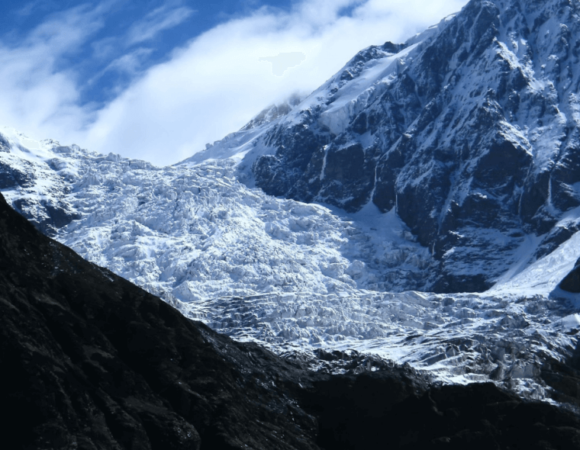
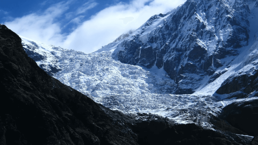
A story that has attracted famous explorers such as Meade, Shipton and Tilman, Martin Moran, Harish Kapadia, and innumerable other brave beings. They were all fascinated by the lore of this priest. The explorations started as early as 1934 with weather, terrain, and courage defeating each person behind. The award of the exploration is the crossing of the Panpatia col, a pass that lurks its way inside sets of moraines, crevasses, and huge icefalls.
In the past, there were many failed expeditions from Badrinath to Kedarnath due to weather and other reasons. In 2000, an English mountaineer Martin Moran begin an expedition to Neelkanth, a nearby peak in the Badrinath area to find a route and then triumphantly negotiated the Panpatia ice falls to exit via Kedarnath presenting the first successful trial of completing Shipton’s route.
| Area | Garhwal Himalayas |
| Duration | 14 days |
| Best Season | Mid May – June – September – Early October |
| Grade | Difficult |
| Altitude | 5260 mts |
| Approximate KM | 135 K.M |


Highlights of Panpatia Col Trek
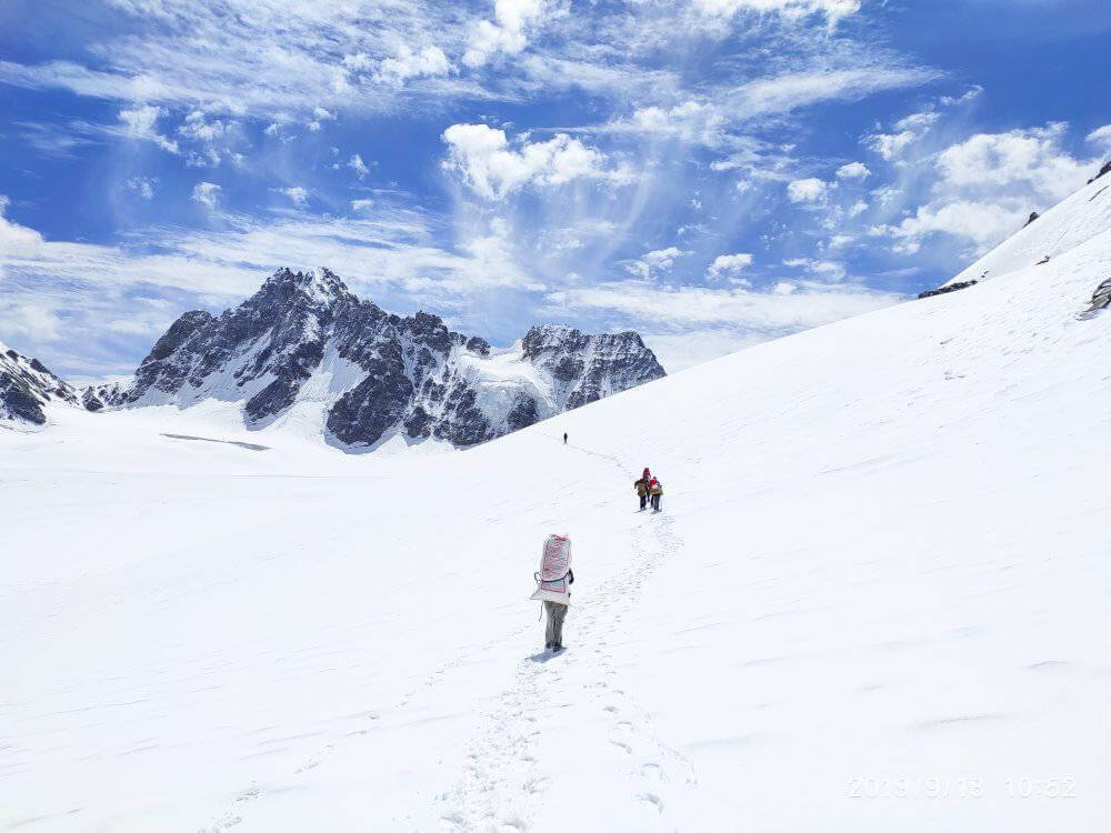
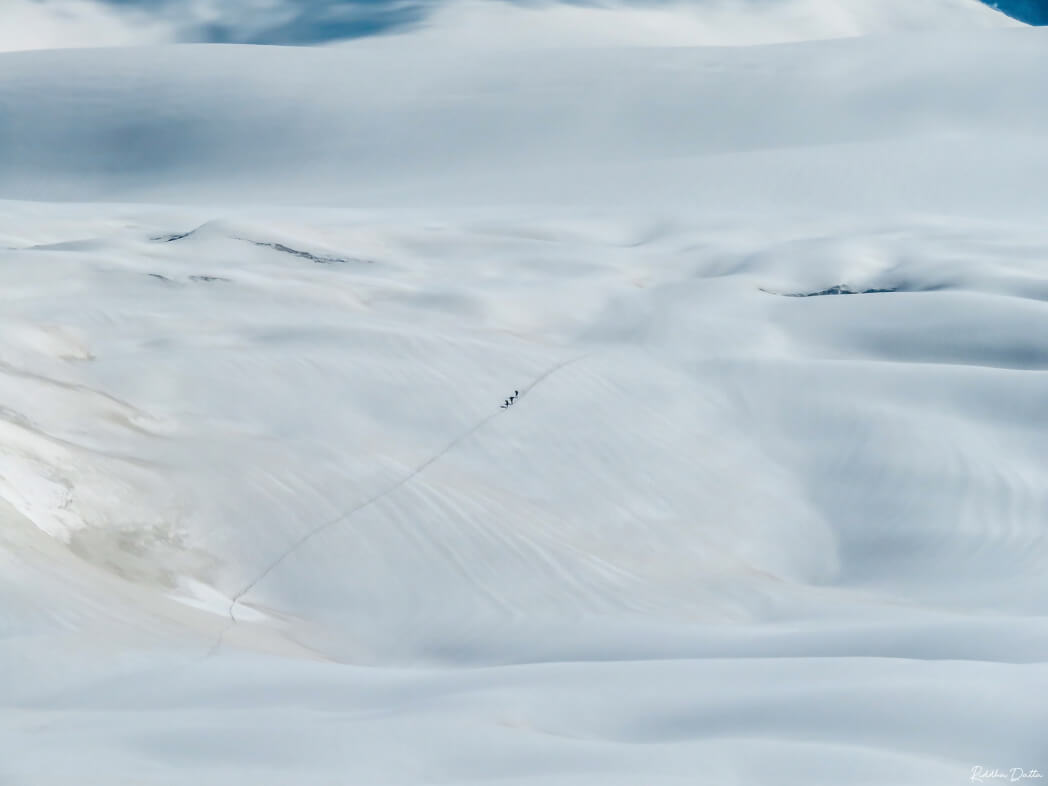
- Panpatia Col Trek takes you through the seven kilometers of the Panpatia snowfield, a unique opportunity.
- The Panpatia Col is a perfect route with enchanting scenes of the high peaks, exciting walks in the snow, dangerous ridges, thin paths hidden by rocks, crevasses, and icefalls.
- The Panpatia Col Trek takes you through all types of terrain.
- Panpatia Col Expedition gives you breathtaking views of major peaks such as Neelkanth, Balakun, Sri Parvat, Kunaling, Hathi Parvat, and Dhauliganga Peaks.
- A historic path with An intriguing mythological story on its origins that a sage performed his daily worship rituals in Badrinath and Kedarnath on the same day.
Location of Panpatia Col Trek
Panpatia is a high mountain pass, which connects the two sacred shrines Badrinath and Kedarnath. According to mythological tales, the sages carried out sacred activities there. Many hikers and climbers have tried to finish this trek but due to some mishap or another, they were unable to do so.
However, in 2000, an English climber Martin Moran directed a journey to Neelkanth, a nearby summit in the Badrinath region to find a way, and then succeeded in negotiating the Panpatia icefalls to exit through Kedarnath, earning it the title of the first victorious attempt of completing the Shipton’s route.
Best Time Visit Panpatia Col Trek
The best time to go to Panpatia Col Trek is in summer (mid-May – June) and after the monsoon (September – early October).
Summer: The climate of Panpatia Col Trek remains good and pleasant during the summers. The Himalayas are visible and the chilly wind adds grace to the vacation.
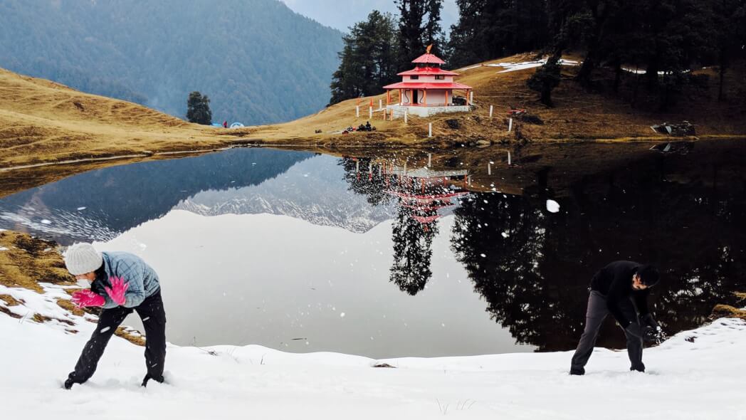
Post Monsoon: Calmness and solitude are at their best during the post-monsoon at Panpatia Col Trek. The area is bestowed with snowfall throughout winters and accommodation possibilities also remain scarce. But you can see the best of Panpatia Col Trek after the monsoon, it feels like heaven on earth.
How to Reach Panpatia Col Trek
By Air –
Jolly Grant Airport is the closest airport to Dehradun and is quickly attainable, only 25 km from the city. Daily flights from New Delhi are available to this airport.
By Train –
Dehradun station. Night trains departing from Delhi are Nandadevi Express and Dehradun Express.
By Road –
Routine bus service is obtainable from Delhi ISBT Kashmere Gate, which operates reliable government buses.
Itinerary of Panpatia Col Trek
DAY 01 : Delhi – Haridwar Rishikesh
In the morning from Delhi train station, take any means of transport to Haridwar. After coming to Haridwar, travel to Rishikesh. Use the rest of the day for recreational activities. Night at the hotel.
Day 02 : Rishikesh – Joshimath (1875 m)
In the morning departure for Joshimath via Devprayag, Rudraprayag, and Chamoli. Upon arrival in Joshimath, check-in at the hotel. Overnight in Joshimath.
Day 03 : Joshimath – Badrinath (3,133 m)
In the morning departure for Badrinath. Upon arrival, visit the famous temple of Badrinath. Overnight
Read more: Bali Pass Trek
Day 04 : Badrinath – Shepherd Camp
On this day the trek to Shepherd’s Camp begins. climb to the edge of the trees, marked by flags on the rocks. Night at the camp
Day 05 : Shepherd’s Field – Snout camp
Spent a day trekking on a blend of terrains. make gentle climbs to steep climbs until you reach Snout of the Panpatia Glacier. Night at the campsite.
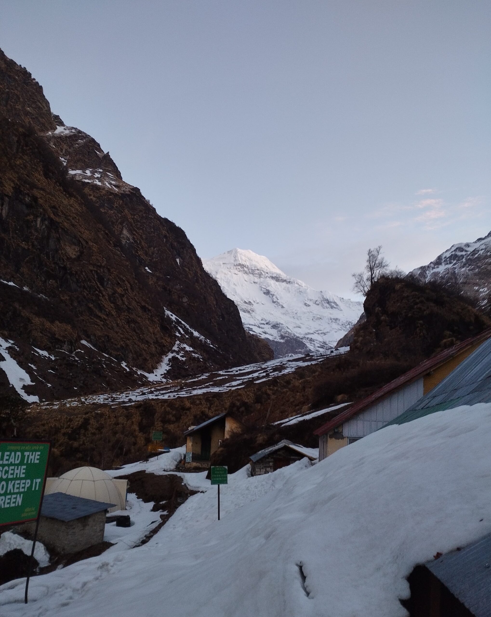
Day 06 : Snout camp- Moraine Camp (4300m)
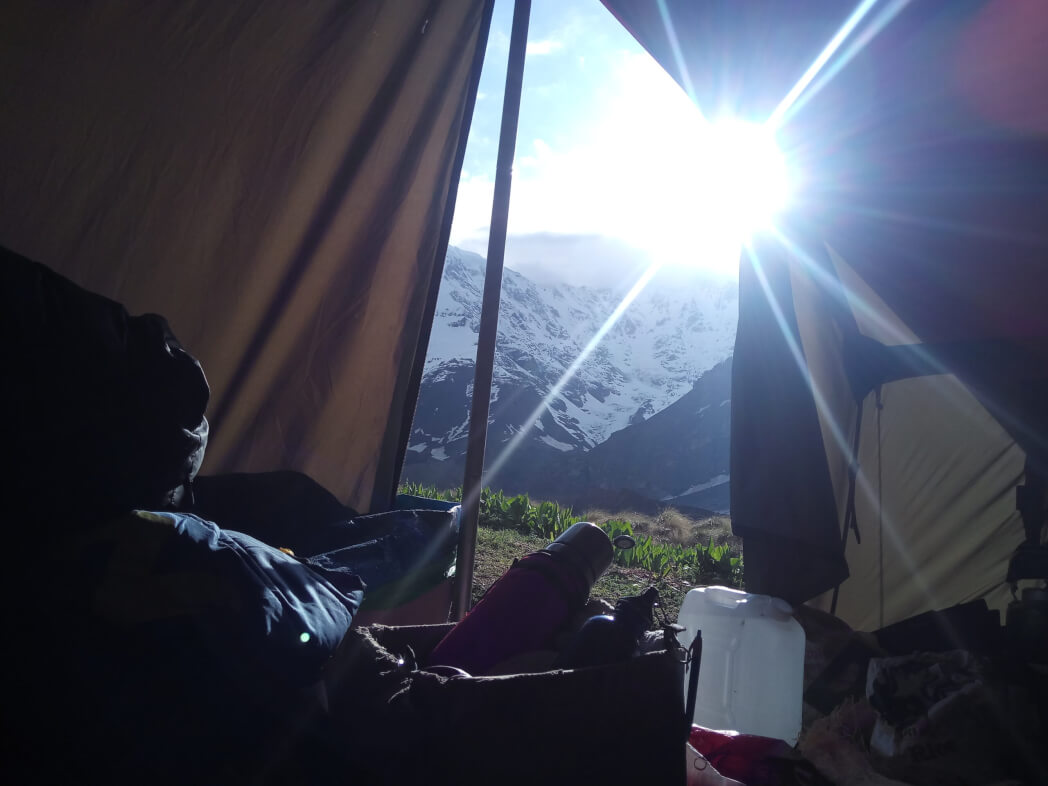
This day of hiking is a bit lengthier. It crosses moraines and passes patches of snow. Reward yourself with a magnificent view of the high Himalayan mountains. Overnight at Camp Moraine.
Day 07 : Rest and acclimatization (4300m)
The day will be left for rest and acclimatization. Night at the camp.
Day 08 : Moraine Camp Base of Parvati Col
This day trek to the base of Parvati Col through the snowfield of Panpatia.The trekking route has steep slopes. camp just below the Parvati pass. Overnight at camp.
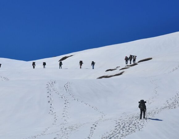
Day 09 : The base of Parvati Col – Panpatia – Camp 1
Climb up to the end of the terrace from there climb a steep covered with snow and rocks. witness Chaukhamba peak, if you are lucky you might even see the fascinating Nanda Devi peak. Overnight at Panpatia Snowfield.
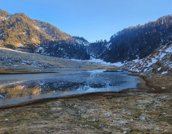
Day 10 : Camp 1 – across the Col Panpatia (5260m) Camp at Sujal Sarovar (4750m)
This day traverses a snowy plateau to reach the Col Panpatia. A steep descent will lead you to the Madhyamaheshwar watershed. camp overnight near the small lake of Sujal Sarovar.
Day 11 : Sujal Sarovar Kachni
Trek to Kachni, which can be reached by walking through slanted and massive areas via a small pass above the Sujal Sarovar. Overnight stay in the camp.
Day 12: Kachni – Nanu chatti
Trek to Madhmaheshwar temple, which takes the cake about 3-4hrs to reach. visit the temple and have lunch at a nearby tea shop. Post lunch, walk through the forests to camp at Nanu chatty, which is a small hamlet of summer homes for people from the villages of Gaundhar. Overnight stay in the camp.
Day 13: Nanu Chatti
Ransi & drive to Rudraprayag On this final day of trekking, descend through the pine forests to get to the bank of Madhmaheshwar Ganga. Trek ends at Ransi, from where the drive to the Rudraprayag. Overnight stay in the hotel.
Day 14: Rudraprayag – Haridwar
Delhi After breakfast drive towards Haridwar via confluence Devprayag where Alaknanda and Bhagirathi embrace each other. Upon arrival at Haridwar transfer to train station and catch AC train for Delhi at 18:05 hrs. Arrival at Delhi by 22:45 hrs.
Frequently Asked Questions (FAQ’s) for Panpatia Col Trek
Where does the Panpatia Col trek start and end?
The trail of the Panpatia Glacier trek originates from Badrinath, landing eventually at Nilkanth Khal
How high is Panpatia Col Trek?
The Panpatia Col is one of the least traversed routes by the trekkers and at a staggering height of 17,258 feet.
How long does the Panpatia Col trek last?
The whole trek is 14 days with approximately 135 K.M of trekking.
When is the best time to go for the Panpatia Col Trek?
The best time to travel to Panpatia Col Trek is in summers (Mid May – June) and Post Monsoon (September – early October).
How difficult is the Panpatia Col trek?
The height above sea level is 5260 m. It connects more than two mountain treks This trek is only for experienced trekkers because it is one of the difficult treks. For the Panpatia col trek, you have to need experience in the hard trek. The most important thing for this trek is that you must choose an experienced trekking company.
How is the weather during the Panpatia Glacier Trek?
The weather conditions during summers and post-monsoons are quite pleasant. During the daytime, the temperature ranges between 15 to 20 degrees, while nights get incredibly cold, with temperatures plummeting to 5 to 10 degrees. The weather will turn a lot colder on higher altitudes
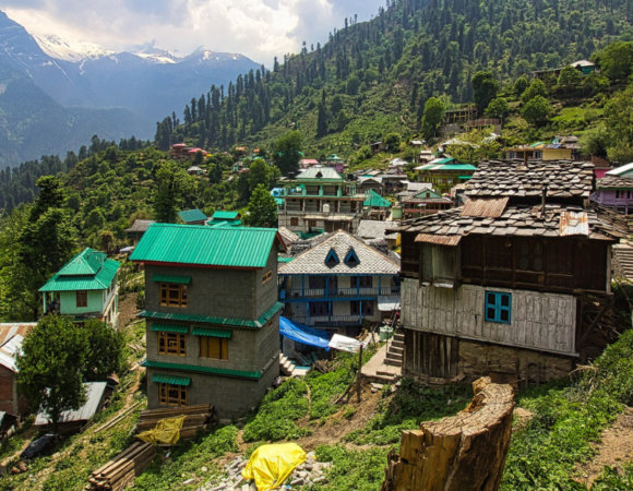
10 Best Hill Station In Himachal Pradesh, Highlights, FAQ’s
10 Best Hill Stations In Maharashtra, Highlights & FAQ’s
10 Best Hill Stations In West Bengal – Best Time, How to Reach Highlights & FAQs
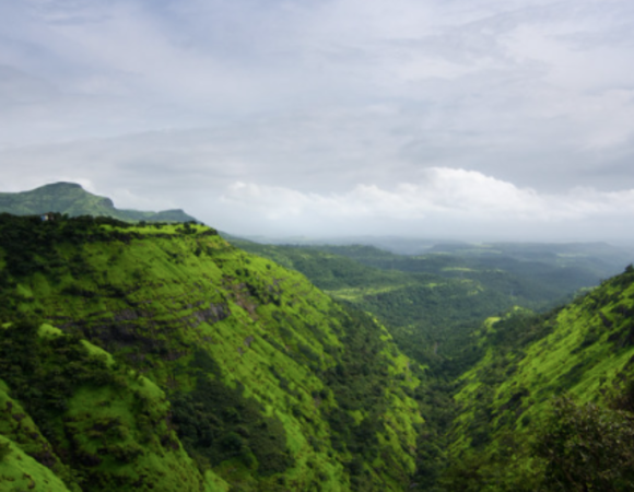
10 Best Maharashtra Trekking Places, Highlights, Treks & FAQ’s
10 Best Trekking Places Near Delhi In 2024 & FAQ’s

10 Best Treks in Himachal That You Can Do in Winters
[…] Read more: Panpatia Col Trek […]