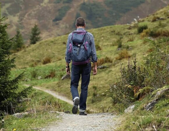
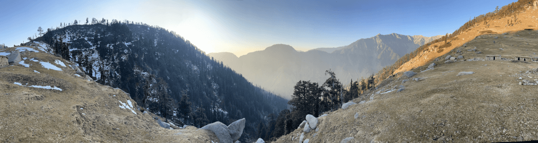
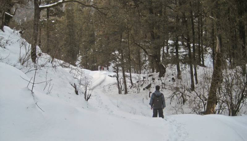
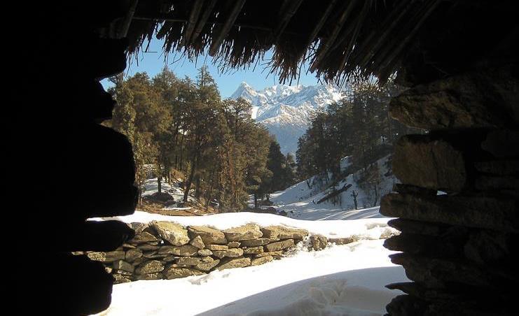
If you are trekking in India, Roopkund Trekking is a must! It has everything you need. Deep pristine forests, bubbling streams, breathtaking campgrounds, miles of rolling meadows, snow and ice, and the kick of great adventure as you ascend from 8,000 feet to 16,000 feet.
Roopkund, in the state of Uttarakhand in India, is a popular glacial lake. The lake is popular because more than five hundred human skeletons were found from the lake. Positioned in the Himalayas almost 4,800 meters above sea level lies Roopkund.
History of Roopkund Trek
Roopkund, located in the Trishul massif, is also renowned as the “mysterious lake”. Human skeletons were found on the lakeshore and are believed to belong to the Paleolithic era. In addition to human skeletons, the skeletal structures of horses and other animals were also found. It was reported that these skeletons belonged from the 12th century to the 15th century.

Experts believed that the cause of these many deaths was the aftermath of landslides, blizzards, or an epidemic. Human skeletons were rediscovered in 1942 by HK Madhwal, who was a ranger at Nanda Devi Game Reserve. Although the specific number of skeletons was not determined. Many scientists believed that people died not because of the epidemic but due to the aftermath of a sudden hailstorm. And it was considered as the main reason behind the extinction of the indigenous peoples of this region.
| Area | Chamoli district, Garhwal |
| Duration | 8 Days |
| Best Season | May and June, Sep, Oct, |
| Grade | Moderate To Difficult |
| Altitude | 15,696 Ft. |
| Approximate KM | 53 Kms. |


Roopkund Trek Highlights
- Explore the mysterious Skeleton Lake, Roopkund, and observe human and animal bones buried for years in the snow.
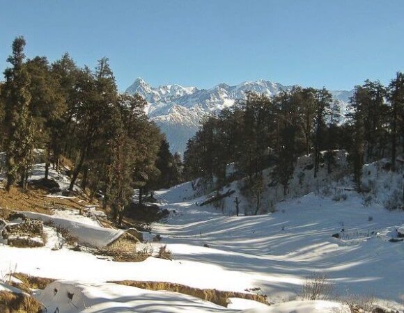
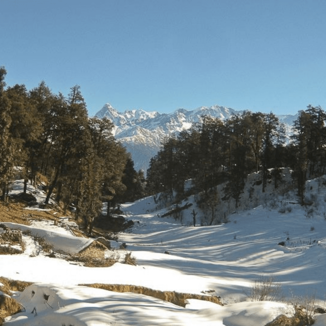
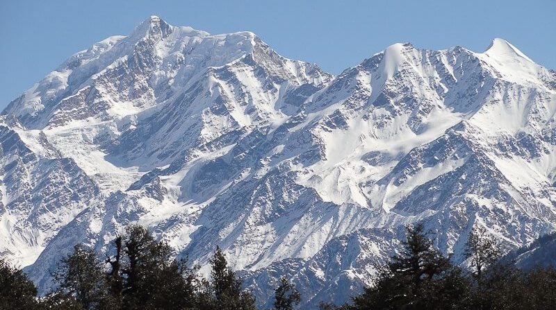
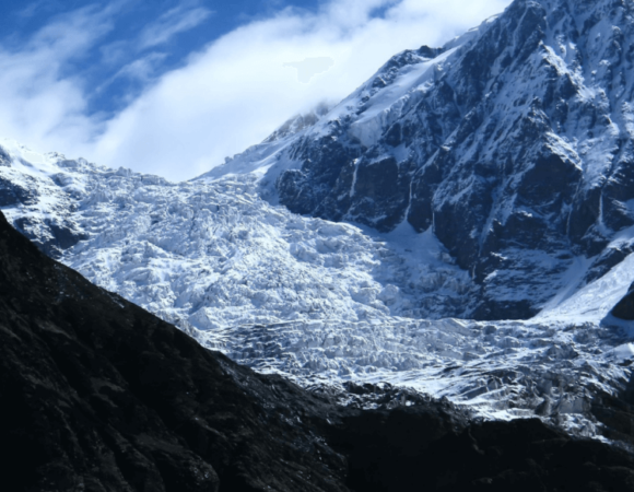
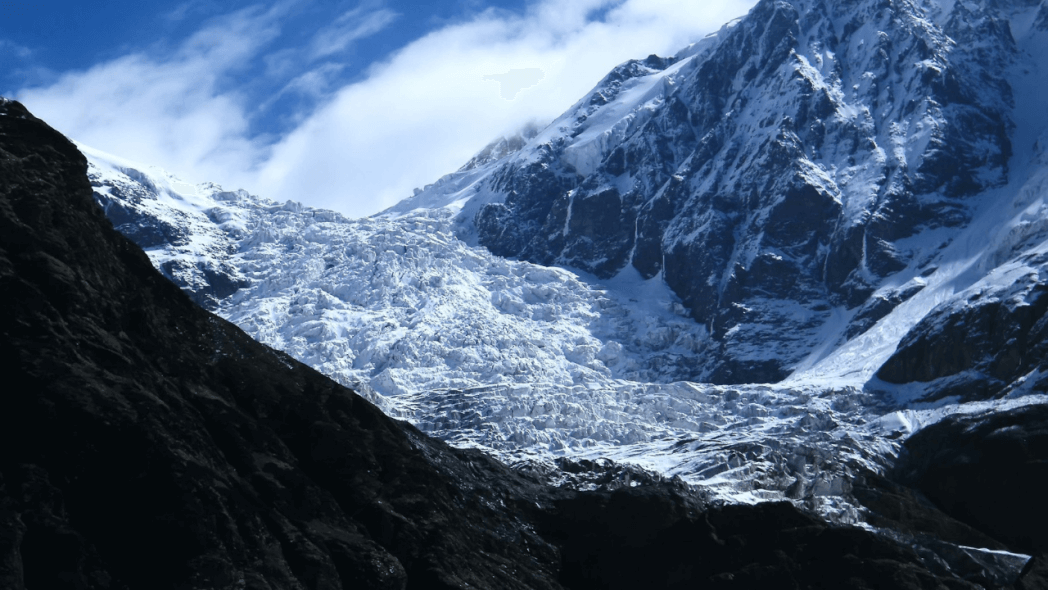
- Relish stunning views of the high Himalayan peaks such as Nanda Ghunti, Chaukhamba, Trishul, and Rudragaira.
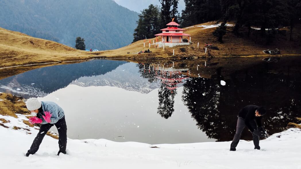
- Relish the lush alpine meadows of Bedni Bugyal and Ali Bugyal.
- Take a moment to explore some of the most remote villages in Uttarakhand.
- Experience camping and breathtaking landscapes.
Roopkund Trek Location
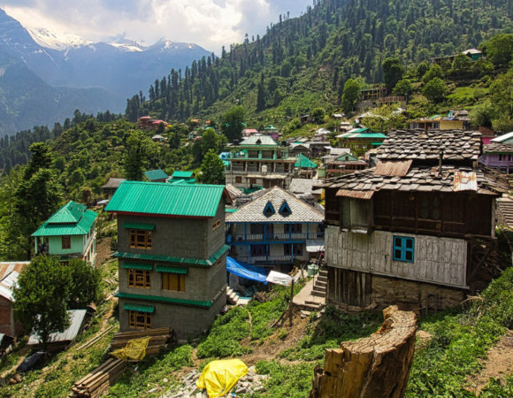
Roopkund is located in the Chamoli district of Garhwal, Uttarakhand. At a distance of 217 km from Nainital and 235 km from Kathgodam, Roopkund is one of the main adventure temptations for locals and also for people coming from abroad.
Best Time to Visit Roopkund Trek
Roopkund can be hiked between May-June and August-October. The severe weather conditions only offer hikers to hike within the 1st week of May and around the 1st week of July. June is a great time to see Ali and Bedni’s twin meadows because at this point they are in their flowering season. Trekking between the last week of August and the first week of October is also a good trekking season in Roopkund. The sky stays pure and the climate is ideal for a hike.
How to Reach Roopkund Trek
Kathgodam Station is one of the main train stations in the area.
By Plane: Jolly Grant Dehradun Airport is the closest airport to Roopkund.
By Train: You could take the Ranikhet Express departing from Delhi arriving at Kathgodam at 5:30 a.m. (overnight trip) or Uttar Sampark Kranti Dep. Delhi at 4:00 p.m. and arrives at Kathgodam around 10:40 p.m. (6 hours and 40 minutes journey). From Dehardun take the Doon Express (4120) Dep. Dehardun at 10:30 p.m. Arrival at Kathgodam at 7:10 p.m. (8-hour journey)
By Road: Ordinary buses are running from Delhi Anand Vihar ISBT station to Kathgodam. Buses going to Nainital stop at Haldwani.
Read more: Hemkund Sahib Trek
Roopkund Trek Itinerary
Day 01: Pick up from Kathgodam in the morning and arrive at Lohajung (2300m, 7500ft)
The winding road passes through the Kumaon region and covers the deep valleys of the Shivalik mountain ranges. The road will lead you to Gwaldam which is located under the administrative district of Garhwal. The road passes through coniferous forests and inexorable curves.
From Gwaldam to Deval, the final destination of the day is not favored because of the damage at various points due to the annual rains. Via Nandkesari the distance gets less, about 11 km, but it is better to walk a longer but safer path through Tharali which is about 36 km. A 2-hour journey will take you to Deval, a village with all the supplies for the purchase of food and kerosene needed for the remaining trip. The last stop of the day’s trip is from Deval to Lohajung.
The extremely winding road gains considerable height. The roads are so exciting to drive that even the slightest of oncoming cars and trucks can give you goosebumps at times. It is generally rainy and foggy for most of the time and the temperature remains very cold. Spend the night in a nearby retirement home or a tourist lodge.
Day 02: Lohargunj to the village of Didna
The real trek begins today. After a good homemade breakfast, the walk begins on level ground after a slight climbing of road by jeep; the road climbs up to the village of Wan. An hour and a half walk on a flat surface will take you to Kulling, which is about 6 km from Lohajung. Kulling is a quiet village in the district of Garhwal, with a small population pool; it is full of the beauties of nature.
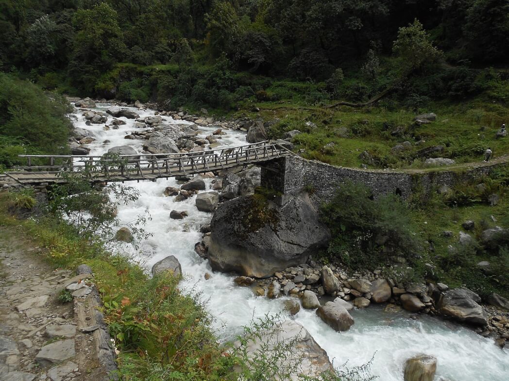
Exotic birds can be spotted very easily; the air is crisp and cool. After a stop in Kulling, you will turn right and gradually descend towards the village. In the beginning, there is a narrow concrete plain that crosses houses and fields and leads to a small stream. This small stream is fed by Neel Ganga. Descend further until you reach Neel Ganga’s bed. Continue and cross the cemented bridge, then start to climb the ridge on the right side of the bridge.
The road ahead is moderately steep. and ends at the village of Didna, located at an elevation of 2,450 meters. The trail embraces evergreen alpine forests and tall trees. After a climb of about two hours, you will reach the top of the ridge; the front view is magnificent. It is surprising to find vast open lands at such a high altitude on the lap of mountains. There are two villages very close to each other, Didna and Kuling, hosting essentially the same type of people and hikers.
The first village is inhabited during the summer and monsoon months while the second is frequented during the winter. The full-day hike ends around 3 p.m. after which a hot lunch is enjoyed. The total distance covered during the day is approximately 10km, and the night will be spent in a traditional guest house.
Day 03: Village of Didna in Ali Bugyal
Today’s trek consists of crossing the lovely village of Ali Bugyal, located at an altitude of 3400 meters or 11000 feet. It is one of the most populous places highs of the country. Ali Bugyal is at the top of the mountain. The trek will take you to the top of this mountain. After the start, the path will take you out of the village. On the right, the path is slightly uphill with a very gentle slope.
Along the way, the temporary settlements of local shepherds known as Tolpani and their huge flocks of sheep are a must-see. They are very friendly and warm in welcoming people; you can also feed them lunch, which they consider a friendly gesture. On the other hand, the path on the left side is short but steeper. But whichever route you take, both will eventually lead you to the same destination.
Oaks, birches, and rhododendrons are the only trees that grow in these areas and they are magnificent and enormous. According to locals, anyone who visits the place in spring can see the incredible view of the valley covered with thousands of brightly colored rhododendron blossoms.
After reaching the top of the mountain, the treeline gradually recedes and the flat meadows begin. The ascent lasts 3 to 4 hours, after which before your eyes, the most beautiful meadows of the Himalayas, Ali Bugiyal welcomes you. During the summer months, wild horses and cows graze in the fields which are filled with vast expanses of grass and flowers of various bright colors.
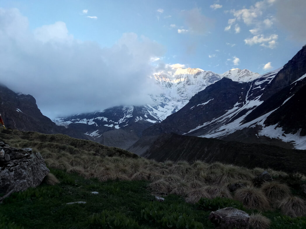
On a clear day, it is easy to see the peaks of Trishul and Mrighthuni, the highest peaks in this part of the Himalayas. After crossing the meadows, you will meet a small wall on the road, and another half hour of trekking will take you to Bedni, the campsite on day 3. After lunch, visit the nearby temple of Bedni Kund, if time permits. You may be able to see the Himalayan ranges of Garhwal in all their splendor.
Day 04: Ali Bugyal in Ghora Lotani
Today, being the 4th day of the trek, you can choose to start a little late and sleep a little more. Your next campsite is Gora Lutani, a perfect place to camp. Keep walking and enjoy the scenic spots in the adjacent area.
Along the way, you will come across Patat Nacholi, a rather unused and usable landmass. That day you will make a steep climb in elevation from about 12,500 feet to 14,500 feet. The high altitude and continuous long walks will hurt your legs and you will also start to feel the effects of climate change and the thin air will make it difficult to breathe.
The beautiful surroundings will give you enough motivation to reach your destination. After a journey of about 10 km, the campsite for the day is reached.
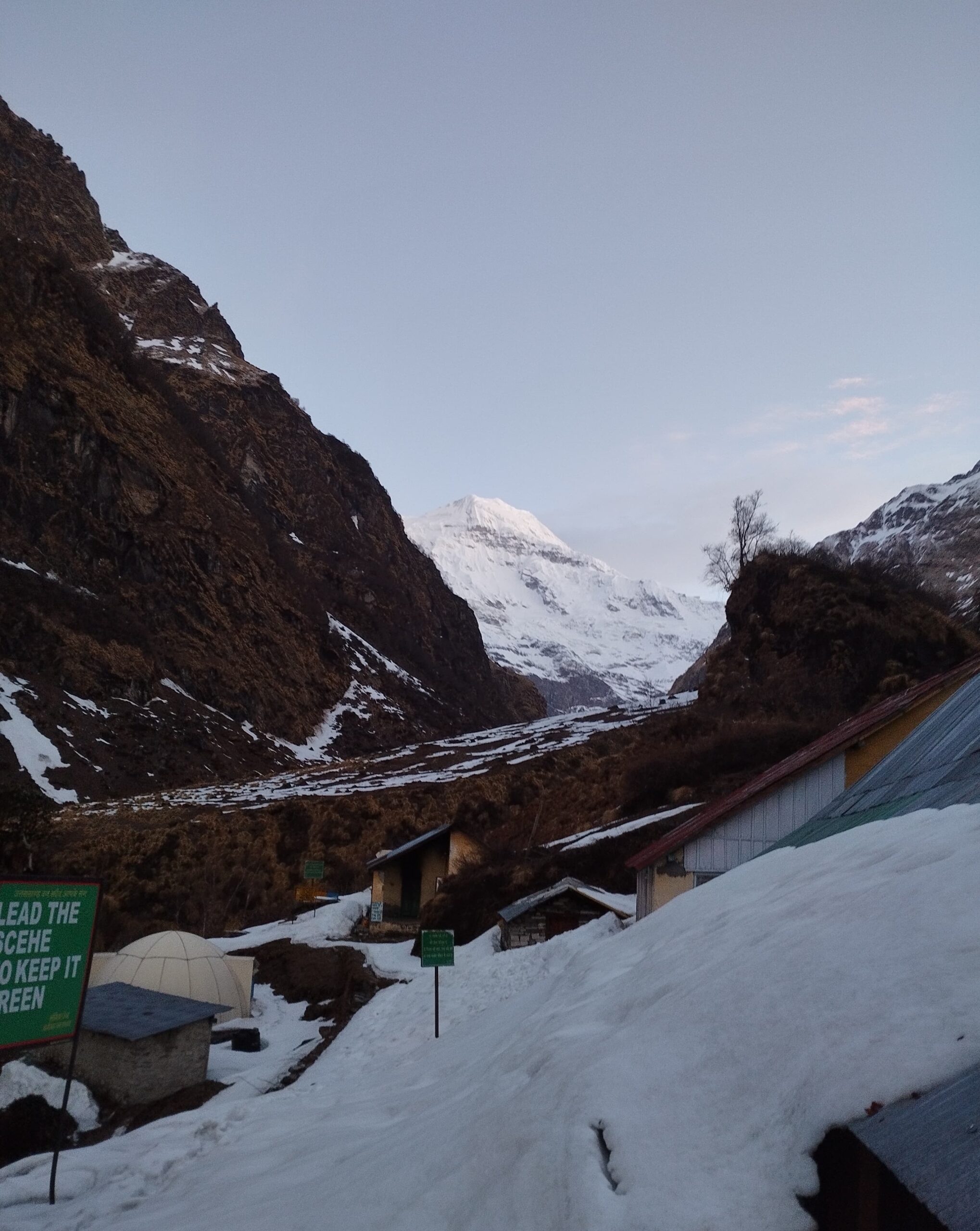
Day 05: Ghora lotani to Bhagwabasa
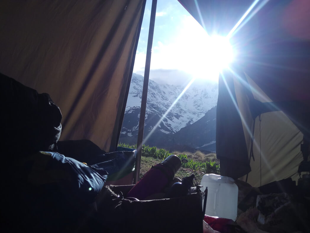
Wake up early and get ready for the longest day of trekking. Eat a hearty breakfast and don’t forget to do some stretching. It should be kept in mind that the trek will cover about 10 km and that too on a steep slope. Walk towards Bhagwabasa, located approximately 14,000 feet above sea level.
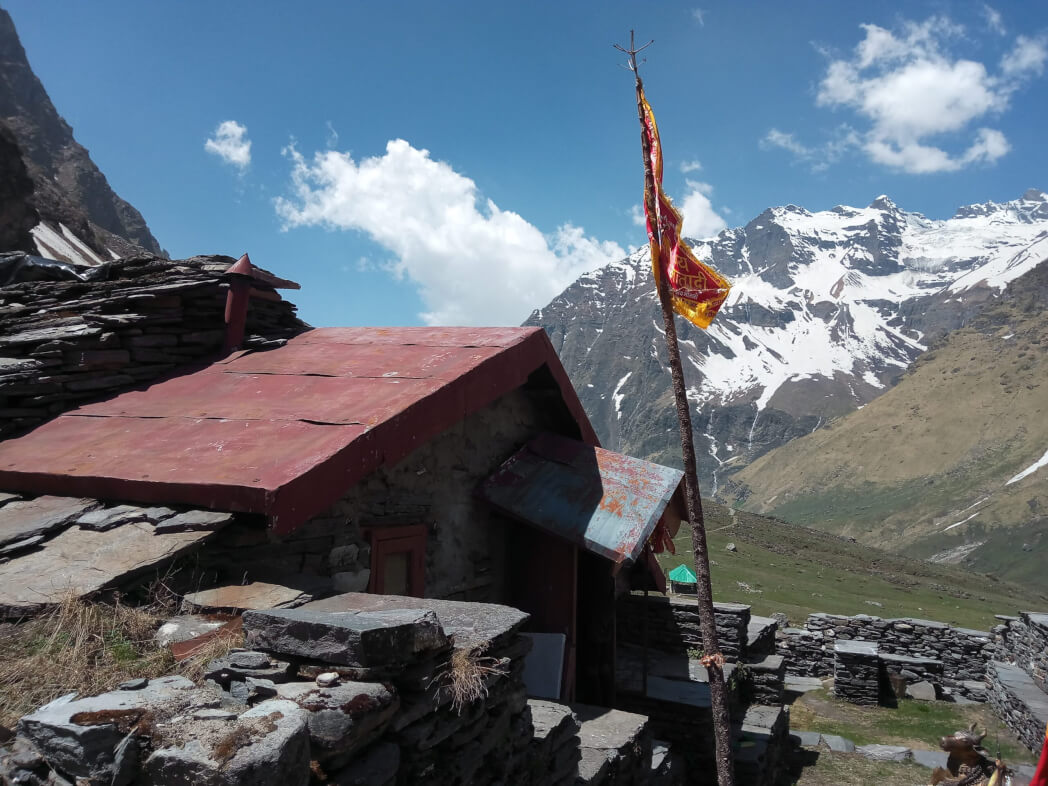
This route will also lead you through the Kalu Vinayak Temple. The most exciting part of visiting the temple is walking 2 miles, which is also equivalent to gaining an elevation of around 200 feet. The path leading to this temple is very irregular and in the shape of a zigzag. Walking should be done very slowly and carefully; a little mistake and anyone can be badly hurt.
But since there is no winning without pain, the freebies await you at the top. It is difficult to understand how anyone could have created the temple at such a height. The temple is fundamentally traditional in design and construction and has been around for centuries. As the altitude increases, the air becomes thinner and the amount of oxygen also decreases which can lead to severe headaches and abdominal pain, but don’t worry, rest.
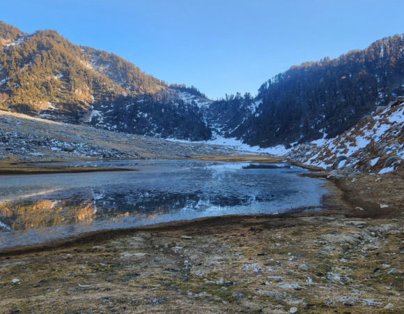
The temple is carved in stone with the greatest precision and perfection. From the temple, you can see Roopkund, the final destination of the trek. The view is simply stunning with shining and sparkling Trishul on one side and bell-shaped Nanda ghunti on the other. Follow the bumpy path further that leads to Bhagwabasa 1 km away. The region has its uniqueness, a few flowers that bloom only during the monsoon months.
Day 06: Bhagwabasa to Roopkund and back to Bedni Bugyal
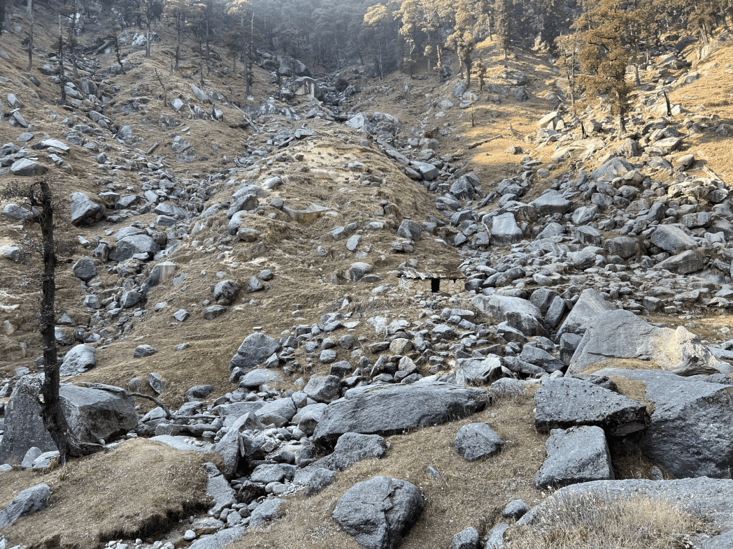
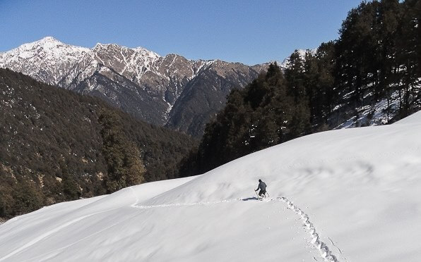
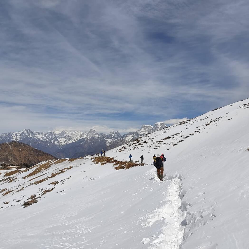
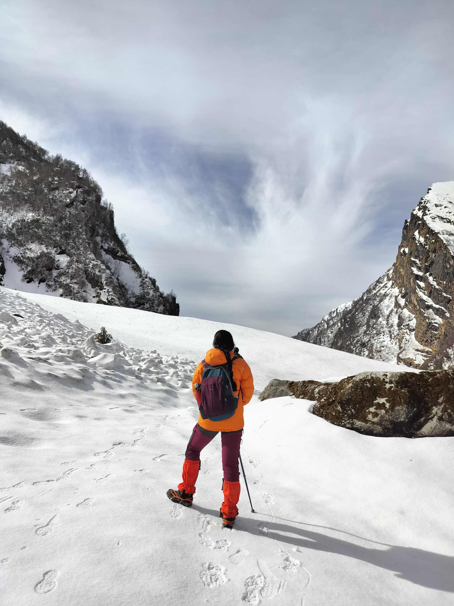
Start early this day to reach the mega destination – Roopkund. At an altitude of over 16,000 feet, this is the highlight of the trek. While the trail is not that complicated to climb, even the 4-mile hike will take your breath away and tire you like hell. But no trekking is easy, is it?
During the monsoon, the snow covering this area is much less abundant and shallow, so the path turns out correctly. From Bhagwabasa, your first checkpoint is Chhirianag which means ladder like a serpent. From this location, the next point is Roopkund – The Island of Mystery.
Skeleton Lake is one of the most mysterious places in the world. Until today, even archaeologists and scientists are unable to find out how there were so many skeletons at the bottom of the lake. Some theories and fables claim that once at one point a king and his companions were on their way to Nanda Devi and unfortunately a strong hail storm resulted in their deaths.
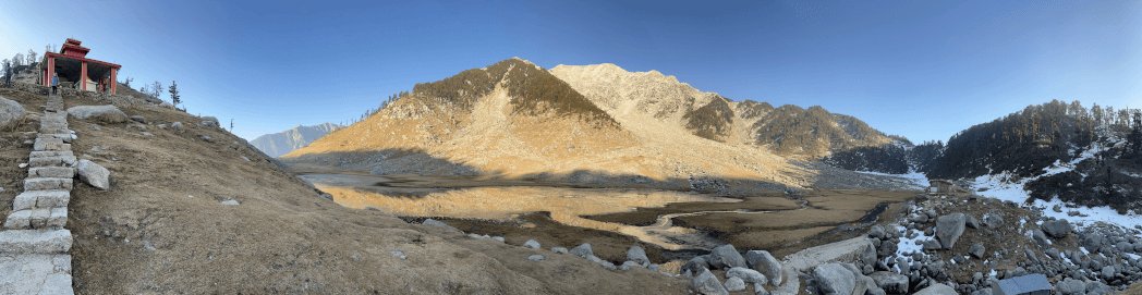
If you are extremely lucky you can see around 300 human skeletons somewhere from the lakeside. This site itself is breathtaking and people go crazy after seeing it. From this point, the hike will be hard with steep terrain. After the steep climb, you will find the Nanda Devi temple. It is very close to the Nanda Devi Biosphere Reserve.
A perfect site for taking good photos with friends and other trekking companions. Depending on the weather conditions, climbers may decide to take a risk on the Junargali pass which is located at 16,700 feet above sea level. Without any weather interference, it would take about 45 minutes to go up. You will need to go through Bhagwabasa on the way back.
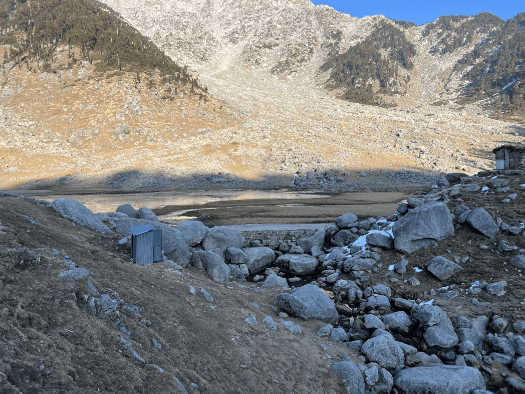
These places are filled with pure euphoria and emotion. The descent along the trail is twice as difficult as the climb, so you might feel like you are falling from above. Continue to discover a cave-like structure called Bhagwabasa or the Tiger’s Abode. Descend further down to reach Pathar Nachuni at approximately 12,500m above ground level.
Return through Ghora Lautani to Bedni Buhyal. Your day will end at the campsite in a green setting. This trip is one of the longest, covering a distance of 15 km. Your legs will prompt you to sleep soundly because they need a lot of rest. But before you go to bed, know that the whole trip was not at all easy and requires a lot of determination and courage to complete it.
Day 07: Bedni bugyal to Loharjung
Day 7 is probably the last day of the trek where you will have to walk and return to the campsite which was there on day 1. The descent and the ascent are two very different things, although the path remains the same. This time you are traveling on the right side of the path and it seems to be a simple path compared to the tiring story the day before.
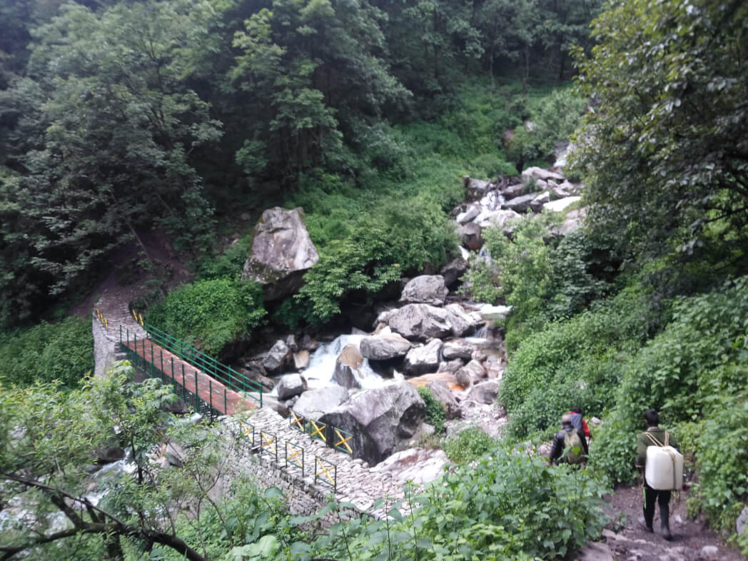
For the first time, you will see wooden cabins scattered along the path. After walking a little further you can now see the road splitting into two lanes. You have to take the one that leads to the right. It goes down and down, and as you go down you can see again that you have entered the forest area with trees all the way.
Due to the variable slope, hikers are advised to be very careful with every step; otherwise, you could end up hurting yourself. Shortcuts should be avoided as much as possible as the terrain is quite rough. After walking a few more meters you will come to an opening in the dense forest called Gahroli Patal.
We continue our journey until we reach the banks of the Neel Ganga river. Once you reach the river bed, your journey continues until you reach the wan village called Ran ka Dhar. Wan village is the next stop after which you get off further. Like home, a large village with rolling hills and mountains covering the edges, a view to be cherished for a lifetime.
So as you walk a few more meters down the road and find the car waiting to pick you up. The distance covered during the day for the descent is almost 18 km and lasts about 10 hours. From Wan, it takes an hour to reach Lohajung. The road traveled by car is stony. Once back at the guesthouse you can revel in all the memories of the trip and sleep comfortably on the warm bed
Day 08: Loharjung to Kathgodam
Wake up early in the morning; have a good cup of tea and a fantastic breakfast in the hills. Today you will leave for Lohajung, with all the beautiful and unforgettable memories, pack your belongings and luggage. Your taxi will drop you off at Kathgodam station.
The drive will take around 10 hours and be sure to bring mint and nausea-preventing tablets with you. From Kathgodam Station you will find trains to various locations. Board your respective train and have a healthy experience with memories that will never fade.
Frequently Asked Questions (FAQ’s) for Roopkund Trek
When is the best time to go to the Roopkund Trek?
Roopkund is a trek that changes beauty before and after the monsoon. If you like snow and a bit of difficult hikes May and June are the best times and if you want to see skeletal and slightly easy hikes September, October is the best time.
How difficult is the Roopkund trek?
Roopkund Trek varies from moderate to difficult depending on the snow level. In the Roopkund Trek, the weather changes in a matter of minutes, so sometimes it becomes very difficult.
How cold is it really during the Roopkund trek?
In the lower fields, the temperature is not so important, but in the upper fields, you have to dress in layers. In the highest camps during the day the temperature will be above 0 degrees and during the night from 0 to 6 degrees
How long does the Roopkund Trek take?
The 8-day Roopkund Trek is almost 53 kilometers long.
How high is the Roopkund trek?
The height of the Roopkund Trek is almost 5029 meters.
What’s the best thing to do in Roopkund Trek?
The Roopkund Trail rises through beautiful dark forests and suddenly enters Ali and Bedni Bugyal, arguably the most beautiful high altitude grasslands in India. Outside the meadows, the trail quickly enters fantastic alpine expanses. Climbing through the snow at Roopkund Lake is thrilling.
10 Best Hill Station In Himachal Pradesh, Highlights, FAQ’s
10 Best Hill Stations In Maharashtra, Highlights & FAQ’s
10 Best Hill Stations In West Bengal – Best Time, How to Reach Highlights & FAQs
10 Best Maharashtra Trekking Places, Highlights, Treks & FAQ’s
10 Best Trekking Places Near Delhi In 2024 & FAQ’s

10 Best Treks in Himachal That You Can Do in Winters

[…] Read more: Roopkund Trek […]
[…] Read more: Roopkund Trek […]