Rupin Pass Trek


7 Days
40 Km
15,279 Ft
18+
Moderate - Difficult
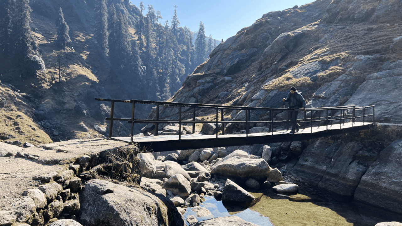
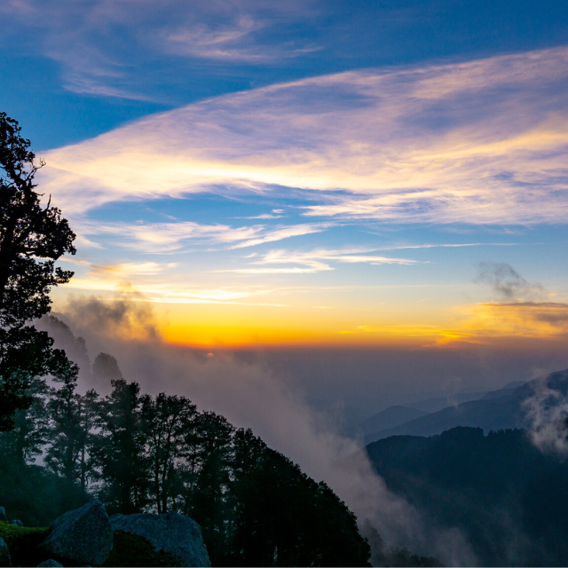
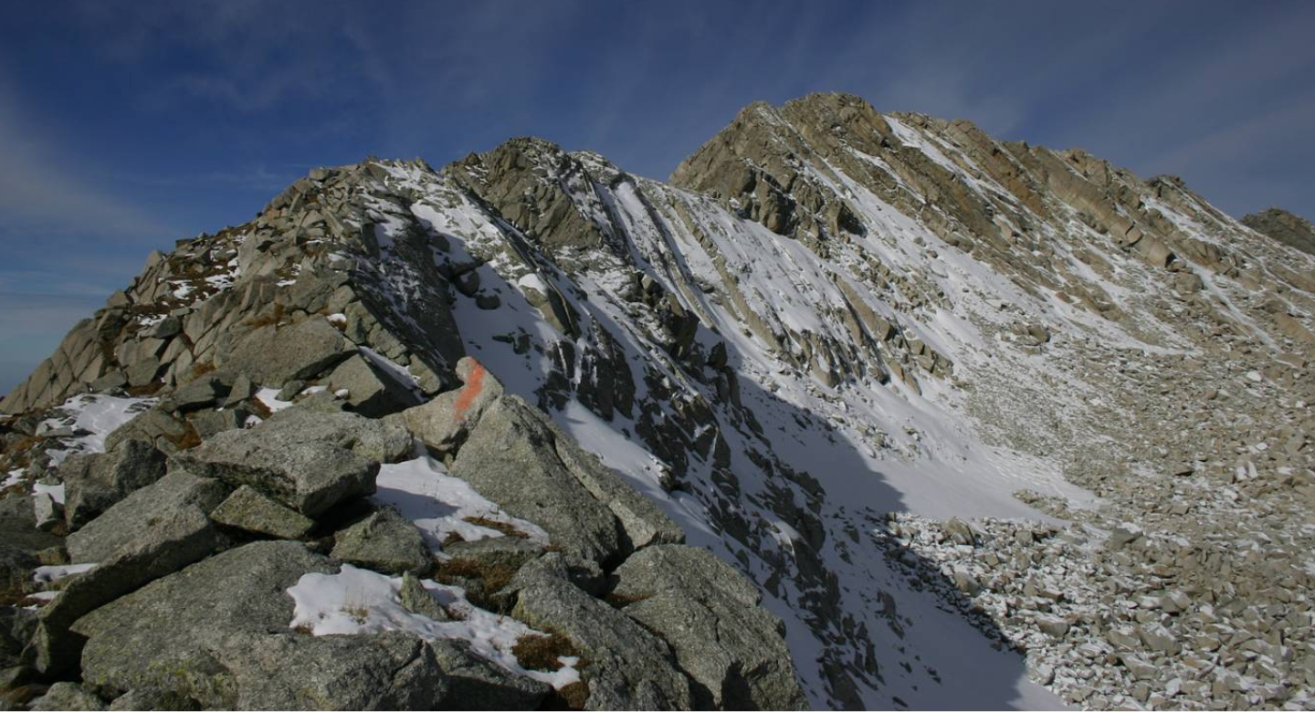
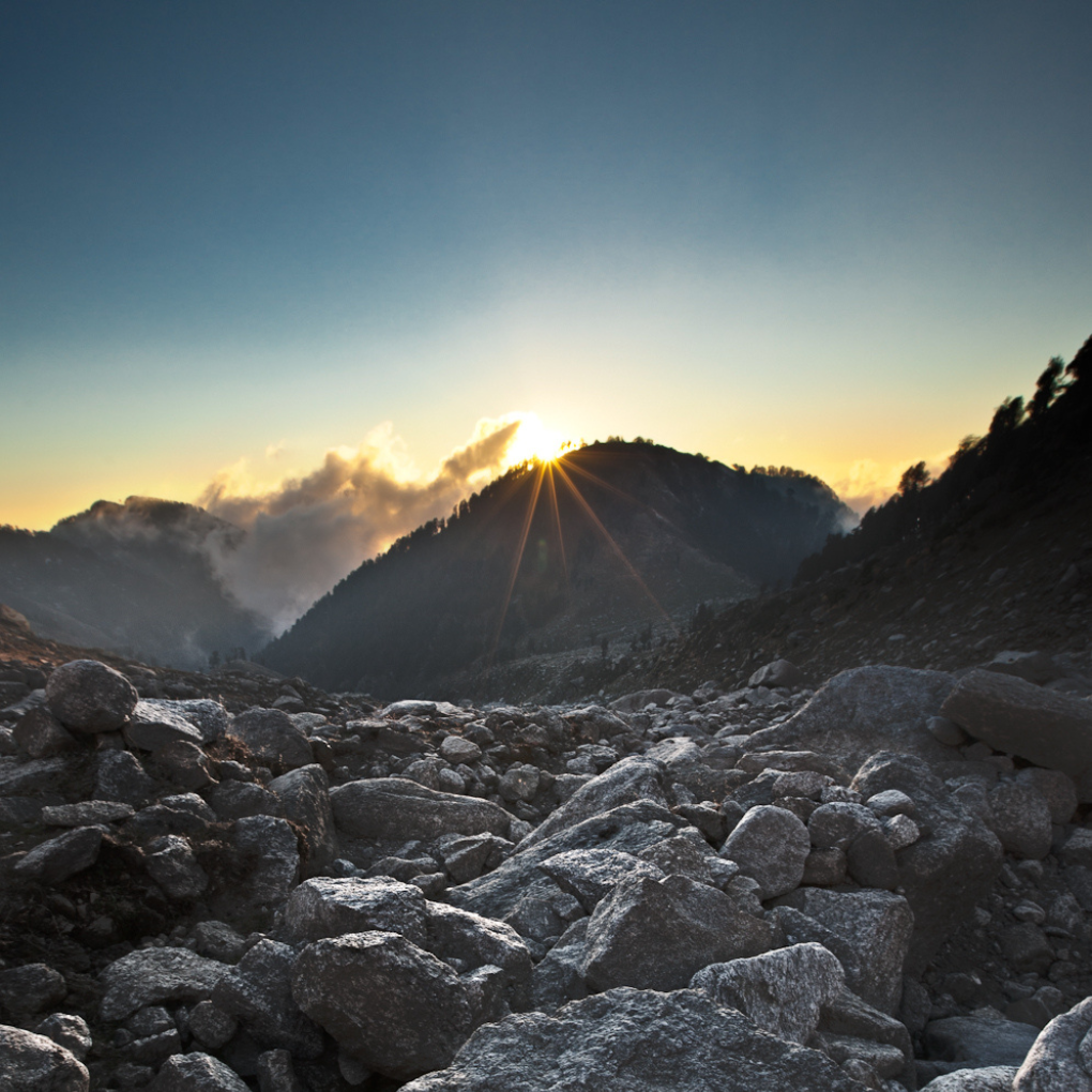
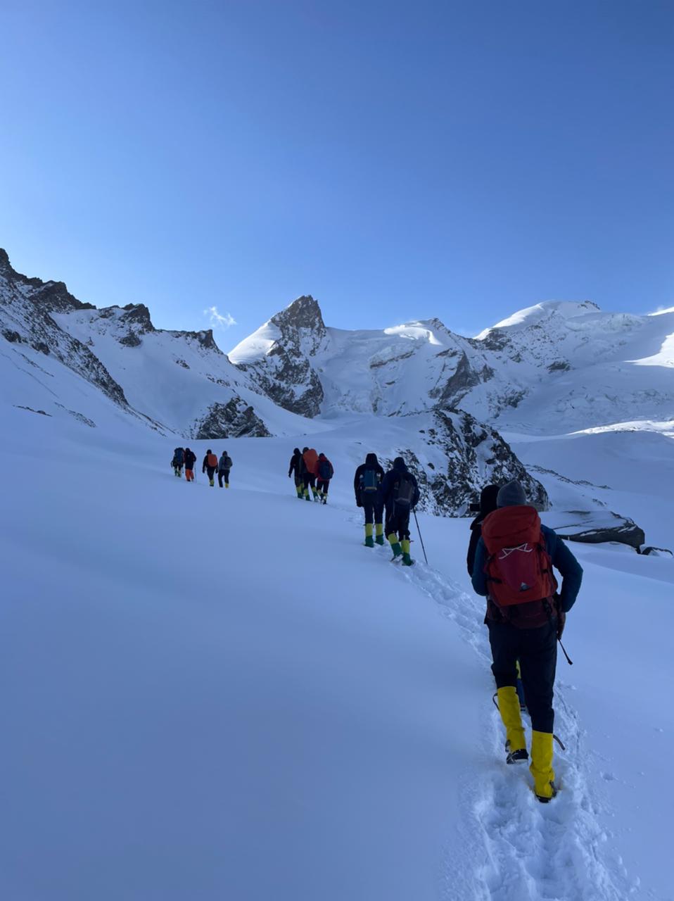
The Rupin Pass Trek is a high-altitude crossover trek that takes you from Dhaula in Uttarakhand to Sangla in Himachal Pradesh, offering an ever-changing landscape filled with dense forests, gushing waterfalls, hanging villages, lush meadows, and snow-covered ridges. The trek, reaching an altitude of 15,250 ft, is renowned for its dramatic scenery and challenging ascents, making it a favorite among seasoned trekkers. The sudden variation in terrain, from lush valleys to icy slopes, makes this trek an unforgettable experience.
Why Choose the Rupin Pass Trek?
- A Classic Crossover Trek: The trail starts in Uttarakhand and ends in Himachal Pradesh, offering diverse landscapes.
- Spectacular Waterfalls & Meadows: Witness the famous three-stage Rupin waterfall and vast alpine meadows.
- Hanging Villages & Wooden Houses: Experience the unique Jhaka village, known as the ‘hanging village’, and traditional Himalayan wooden architecture.
- Adventurous & Challenging Terrain: The trek offers a thrilling mix of terrains from steep snow bridges to rocky ascents.
- Breathtaking Pass Crossing: The final climb to Rupin Pass (15,250 ft) rewards trekkers with awe-inspiring panoramic views of the Kinner Kailash range.
Included/Excluded
Nikhil

Member Since Apr 2024
Select Dates
{{type.name}}
{{type.display_price}} per person
Guests
Extra prices:
- {{total_price_html}}
- {{pay_now_price_html}}
Guest in maximum
BOOK NOW Book NowBook With Confidence
Itinerary for
Rupin Pass Trek
Day 1

Day 2
Day 3
Day 4
Day 5

Day 6

Day 7
Complete Rupin Pass Trek Information
The best time for the Rupin Pass Trek is May to June (pre-monsoon) and September to October (post-monsoon).
-
May to June: Spring-summer season with moderate snow, blooming rhododendrons, and pleasant weather.
-
September to October: Post-monsoon clarity, vibrant autumn hues, and a snow-free pass crossing with breathtaking views.
Avoid monsoon (July-August) due to heavy rainfall, landslides, and slippery trails, and winters (November-April) due to extreme cold and heavy snowfall blocking the route.
By Flight (Fastest Option)
-
Nearest Airport: Jolly Grant Airport, Dehradun (DED)
-
Distance: ~200 km from Bawta
How to Reach Bawta from Dehradun Airport:
-
Take a taxi/private cab to Mori (160 km, 6-7 hours) via Purola.
-
From Mori, hire a local shared jeep or taxi to reach Bawta (40 km, ~2 hours).
By Train (Budget-Friendly Option)
Nearest Railway Stations:
-
Dehradun Railway Station (200 km from Bawta) – Well-connected to major Indian cities.
-
Haridwar Railway Station (240 km from Bawta) – Good option for travelers from Delhi, Mumbai, and Kolkata.
How to Reach Bawta from Dehradun/Haridwar:
-
From Dehradun or Haridwar, take a bus/shared taxi to Mori via Purola.
-
From Mori, take another jeep/taxi to Bawta (~2 hours).
By Bus (Cheapest Option)
-
From Delhi to Dehradun: Take an overnight Volvo/ordinary bus from ISBT Kashmere Gate (~6-7 hours).
-
From Dehradun to Mori: Take a direct bus or shared taxi (~6-7 hours).
-
From Mori to Bawta: Hire a local taxi/jeep (~2 hours).
Pack smart, trek safe!
Ensure you're prepared for every adventure with this essential checklist of gear and supplies. Whether you're a beginner or a seasoned trekker, the right equipment makes all the difference. Download checklist's pdf here
Basic Gear
| Backpack with Rain Cover | (40 - 50 ltr) Comfortable Shoulder Straps |
| Day pack with Rain Cover | 20 - 30 ltr (If off-load opted) |
| Walking stick | Advisable (At least one) |
| Water Bottle / Hydration pack | 2 Bottles(1 liter each), Hydration Pack 1 (Pack) + Bottle |
| Small size tiffin/lunch box | 1 Nos |
| Snacks | Energy bars, dry fruits, electral/ors |
| Personal Medical Kit | Consult your doctor |
Clothing
| T-Shirt (Synthetic quick dry) | 1 Full & 1 Half sleeves |
| Fleece T-shirt | 1 Nos |
| Wind stopper / Fleece jacket | 1 Nos |
| Windproof Jacket | 1 Nos |
| Down feather / Hollow jacket | 1 Nos |
| Thermal inner (Upper and Lower) | 1 Nos |
| Trek Pant (Synthetic quick dry) | 1 Nos |
| Wind stopper / Fleece Pant | Not required |
| Waterproof gloves | Not required |
| Fleece / woollen gloves | 1 Pair |
| Poncho / waterproof Jacket and pant | 1 Nos |
Head Gears
| Head torch | 1 Nos. (Avoid Hand torch) |
| Sun cap | 1 Nos. (One that covers the neck as well) |
| Woolen cap | 1 Nos. |
| Balaclava | Not required |
| Buff / Neck-gaiters | 1 Nos |
| Sunglasses | UV with dark side cover, People who wear spectacles - (A)- Use contact lenses | (B)- Photo chromatic glasses |
Foot Gears
| Trekking shoes | 1 Pair (Waterproof, high ankle with good grip) |
| Floaters / flip-flops | 1 Pair |
| Cotton socks | 6 pairs |
| Woollen socks | 1 pairs |
| Gaiters | 1 Pair (provides when required) |
| Micro spikes | 1 Pair (provides when required) |
Personal Utilities
| Sunscreen cream | 1 Nos |
| Moisturiser | 1 Nos |
| Chap-stick / Lip balm | 1 Nos |
| Toothbrush and toothpaste | 1 Nos |
| Toilet paper & Wipes | 1 Nos |
| Soap / hand sanitizers | 1 Nos |
| Antibacterial powder | 1 Nos |
| Quick dry towel | 1 Nos |
At Scoutripper, we understand that plans can change. You can reschedule your booking up to 24 hours before your experience begins. Changes are subject to availability and any applicable price adjustments. Rest easy knowing your adventure is flexible!
At Scoutripper, we value flexibility but also adhere to clear cancellation guidelines:
- Full Refund: Cancel at least 6 full days before the experience starts.
- 50% Refund: Cancel between 2 and 6 full days before the start time.
- No Refund: Cancellations made less than 2 full days before the experience start time will not be refunded.
Additionally:
- Changes are not accepted less than 2 full days before the experience begins.
- Cut-off times are based on the local time of the experience.
- Some experiences require a minimum number of participants. If the minimum isn’t met, you’ll receive a full refund or the option to reschedule.
Enjoy peace of mind with our clear and transparent policies!
Mobile Network & Internet:
-
Last network availability: At Dhaula (starting point of the trek).
-
Jio & Airtel work best, but connectivity is weak after Dhaula.
-
No mobile or internet connectivity at higher campsites and Rupin Pass.
ATMs & Cash Availability:
-
Last ATM point: Purola or Mori, but they may not always have cash.
-
Best option: Withdraw cash in Dehradun before heading towards Dhaula.
-
Carry ₹4,000–6,000 for food, local transport, and emergencies.
Electricity & Charging Points:
-
No charging points at the base camp (Dhaula) or any campsites.
-
Teahouses may offer limited charging at lower altitudes for a fee.
-
Carry a power bank (minimum 10,000mAh) to keep devices charged throughout the trek.
-
Cold temperatures drain batteries faster, so keep them warm inside your sleeping bag.
FAQs about
Rupin Pass Trek
The Rupin Pass Trek is located in the Himalayas, spanning Uttarakhand and Himachal Pradesh, India. The trek starts from Dhaula in Uttarakhand and ends in Sangla, Himachal Pradesh, offering breathtaking views of snow-clad peaks, waterfalls, and hanging villages.
The trek is moderate to difficult, requiring good physical fitness and endurance. It involves steep ascents, tricky descents, and long trekking hours, especially near Rupin Pass at 4,650 meters (15,250 feet).
The best time for the trek is May to June (pre-monsoon) and September to October (post-monsoon). Spring offers snow-covered landscapes, while autumn brings clear skies and golden meadows. The trek is closed in winters due to heavy snowfall.
The Rupin Pass Trek takes about 7 to 9 days, covering approximately 52 km from Dhaula to Sangla.
Yes, permits are required for trekking in forest areas and crossing state borders. These can be obtained on-site or through trekking agencies organizing the trek.
The highest point of the trek is Rupin Pass at 4,650 meters (15,250 feet). It offers stunning 360-degree views of Kinnaur Kailash and other Himalayan peaks.
Yes, since the trek goes above 4,500 meters, some trekkers may experience altitude sickness. Proper acclimatization, hydration, and a slow ascent help in avoiding symptoms like headache, dizziness, and nausea.
Trekkers stay in campsites at various points along the trail. In the starting and ending villages, there are basic homestays and guesthouses available.
Meals typically include dal, rice, roti, vegetables, soups, and energy snacks. Some villages along the route offer basic local food, but at higher campsites, food is provided by trekking groups or needs to be carried.
The Rupin Pass Trek is famous for its ever-changing landscapes, hanging villages, lush meadows, icy slopes, and thrilling high-altitude pass crossing. It is one of the most scenic and adventurous crossover treks in India, making it a bucket-list trek for experienced trekkers.
You might also like